A talk presented at the 2015 Tamarisk Coalition Conference in Albuquerque, New Mexico.
Showing posts with label La Jencia. Show all posts
Showing posts with label La Jencia. Show all posts
Wednesday, February 11, 2015

Friday, July 12, 2013
Riparian Restoration Quandary
Plants along rivers face a basic quandary: the closer to the channel they grow, the more water they have. But, closer to the channel, there is more disturbance from flooding.
 So:
It has:
It might be important to ask: What is bankfull here?
It might also be important to know that this is actually a dry wash, photographed after the first rain in 9 months...it looks grazed, and it is grazed. By a herd of native Elk, forced out of the uplands by the worst drought in 50 years.
We have to be careful to set our ecological expectations to the history of natural disturbance and the reality of a changing climate.

- Is this a healthy/unhealthy stream bank?
- Is it in need of restoration?
It has:
- invasive species
- sparse vegetation
- obviously eroding banks....
It might be important to ask: What is bankfull here?
It might also be important to know that this is actually a dry wash, photographed after the first rain in 9 months...it looks grazed, and it is grazed. By a herd of native Elk, forced out of the uplands by the worst drought in 50 years.
We have to be careful to set our ecological expectations to the history of natural disturbance and the reality of a changing climate.
Friday, July 05, 2013
La Jencia Flash Flood!
Moving at about 5 miles per hour (as judged by floating tumbleweed), the front of the flood (visible here with lots of foamy flotsam) made a roaring sound easily audible at the ranch house. The brunt of the thunderstorm had passed more than half an hour previous. Based on cross sections of this reach, the flood was only about 30cm deep, and represented a flow of approximately 50 CFS. This amount of water may be "bankfull": the bank-side sedges were underwater, the willow got their feet wet, and no major channel geomorphic changes occurred.

Advancing front of flash flood.

The next day.

Monday, November 16, 2009
La Jencia Restoration Project Evaluation after 10,000 CFS Summer Flood
"No characteristics of the channel provide indication of why some reaches scoured when the rest of the reach filled ... When there are a large number of interrelated factors which must adjust among themselves in response to occurrences in the environment, such as storms or flows, it should be expected that there will generally be an indeterminacy in the manner of this mutual adjustment.... Where a particular factor dominates, such as a bedrock floor of a channel, the effects of this factor may be readily evident. However, where the alternatives become more nearly equivalent it becomes more difficult to specify the precise form in any give case...This indeterminacy in a given case results from the fact that the physical conditions, being insufficient to specify uniquely the result of the interaction of the dependent variables, are controlled by a series of processes through which any slight adjustment to a change imposed from the environment feeds back into the system." (Leopold, Wolman, Fluvial Geomorphology. describing the equivocal results on their study of the dry wash (ephemeral channel) near Santa Fe, NM Arroyo de los Frijoles:)
 |
| From La Jencia Assessment Fall 2009 |
Context: La Jencia Ranch is located near the continental divide, west of the Rio Grande, north of the Magdalena mtns at about 5500 feet in a broad almost-closed basin composed of Pleisticene-sediment. Springs feed an intermittent reach in what is otherwise an ephemeral system. The watershed above this point is approximately 350 square miles, and large bursts of storm water have contributed to massive erosion in this area. By anecdotal reports, this entire canyon system (with 100+ foot walls) has cut in the last 120 years since Anglos homesteaded in the 1880s. This report is corroborated by the evidence of recently rejuvenated side canyons and active headcuts.
A continuing riparian restoration project has been focused on planting trees throughout the developing floodplain and meander cutoffs near ranch HQ. The continued lateral and vertical (down-cutting) erosion in the canyon is a management concern.
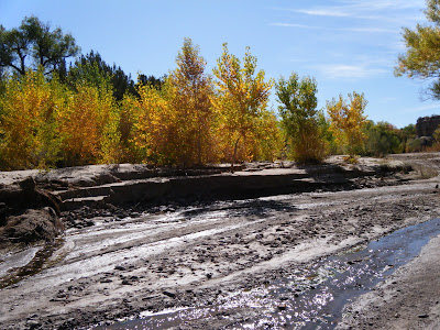
In the storm of 2006 a number of major hydrogeomorphic changes took place, notably the cutoff of several large meanders. This had the effect of significantly shortening and steepening the main channel. In a ~10 foot flood this September, another large meander was cutoff, in addition to significant erosion (and deposition) in other parts of this very dynamic system.
 |
| From La Jencia Assessment Fall 2009 |
Observations:
scoured out or deposited feet of sediment on benches cuts some places, stable others
looks like it wants to meander morehas active floodplain
flood was 6-10 feet high
widened in some places
in other places sedges and willows in middle survived
large meander cutoff downstream of house
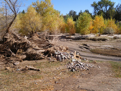
General Conclusions: did not downcut (degrade) during this flood, contra the 2006 flood. While an over-meander did cutoff as could be expected, it did not create a headcut, as was feared.
stream has access to floodplain. some deposition and scour over this surface is natural. La Jencia is a high-disturbance system.
NOT Down-cutting, and possibly AS GOOD AS IT GETS
 |
| From La Jencia Assessment Fall 2009 |
Caveats: It is important not to be drawn into individual cut banks, but rather to evaluate the system on a whole.; "the failure of some in stream willow plantings (ISWP) does not invalidate the concept". In fact, some of the outside-meander plantings did hold. Other reaches of the channel that don't bend as much and had thick sedge growth were almost unchanged. Eventually, the entire channel could look like these reference reaches. However, whether planting can drastically change what would already happen otherwise, is unknown. Perhaps more a function of how many years between scouring floods.
Problems: inability to think in derivatives (rates)
"average" wide distributions of high frequency-low magnitude events with low frequency-high magnitude events
talk about average or equilibrium in the midst of constant flux (writhing serpent metaphor for channel evolution)
think about very complex systems (see climate change). things are changing, but is there a trend (what scale to think (average) at?) and are we affecting it?
compute running averages at different scales
Case Examples:
There's a difference between downcutting (lowering of base elevation) and degrading, which could include lateral erosion. Steepening is another thing altogether. So, for example, at the meander cut-off, the grade steepened and the channel length shortened, but a headcut did not start, and areas immediately upstream and downstream are still at the same elevation, so downcutting did not occur. Whether this area ends up aggrading at the bottom of the steepened section or degrading at the top of the section depends on the nature of future hydrographs and sediment supplies.
Uplands:
The uplands are key to understanding how "natural" the channel evolution and morphology are. Grazing stress has been removed on-site, but could still be contributing to watershed degradation. Measurements of runoff on grazed and ungrazed areas of the watershed could yield calculations about the magnitude and frequency distribution of floods. La Jencia, like other ephemeral streams, may not be wet enough to support enough veg to maintain stability in the face of giant floods. Or maybe floods are changing in magnitude.
If the channel is slightly unstable, as indicated by the variance of Van's channel cross sections, this continued instability could be attributed to the nature of the system (basically, ephemeral) and/or the condition of the contributing watershed (degraded, causes increased ephemerality and flashiness).
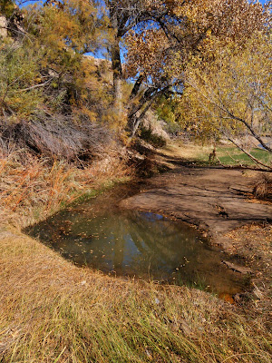
Van emphasized the sediment supply could be contributing to instability, and that this sediment was locally generated by the magnitude of these events. Was this a 20-year flood?
 |
| From La Jencia Assessment Fall 2009 |
"Apparently the tendency for the maintenance of quasi-equilibrium in stream channels is sufficiently pervasive that only slight deviations, if sustained for long enough periods of time, may account for aggradational features of considerable magnitude, but the deviation from equilibrium conditions necessary for the construction of such depositional features cannot be recognized or identified by any criteria now available. Only by measurement over time can the net direction of river change be determined..." (Leopold, ibid)
Friday, October 17, 2008
La Jencia Grassland Restoration Pilot Project
In an effort to control erosion at La Jencia Ranch, native upland (facultative wet) grasses and forbs were seeded around the leading edges of headcuts.
 Plot 1.
 Plot 2
 View of erosional gully.
 Grasses
Purple Three 5%
Side-oats grama 30%
Indian Ricegrass 16.25%
Galletia 10%
Western Wheatgrass 20%
Wildflowers
White Prairie Clover 7.5%
Purple Prairie Clover 5%
Rocky Mountain Beeplant 1.25%
Prairie Sage 2.5%
Scarlet Globemallow 1.25%
Prairie Coneflower 1.25%
plus saltbush (plot 1) and winterfat (plot 2)
Tuesday, February 26, 2008
La Jencia Documentation
 [Overview map of La Jencia jobsite. The flow is from bottom (South) to top (North).]
Although La Jencia watershed is subject to ephemeral flooding events, the creek itself is perennial from springs ~100m upstream of our jobsite to its confluence with the Rio Salado. There is ample evidence that this system has downcut substantially in recent years. In fact, current GoogleEarth satellite photos record a markedly different channel from the current one. The older channel was probably active within the last two years.
 [Blue marks the channel recorded from GoogleEarth; Red marks the approximate course of the new channel. Note the linearization of the former meanders. #7 denotes the position of the next photo.]
On the ground it is obvious that this new channel is 3-5 feet lower than the previous channel/floodplain.
 [Blue denotes approximate position of former channel; Red denotes current channel. The wetlands/spring in the bottom of the photo confirms continued subsurface flow along the old meanders. The bank with machinery on it is several feet above the new bankfull channel.]
Due to the lack of on-site building materials and other reasons, our project does not directly address the channelization and downcutting but instead attempts an oblique approach to these hydrogeomorphic issues; by suppling more vegetation to slow and absorb large flow events we can limit further erosion as well as build up biomaterial that could someday provide substrate to dam, sediment, and eventually reconnect La Jencia with its floodplain.
 [Upper La Jencia 2008 Jobsite.]
 [Lower La Jencia 2008 Jobsite.]
We planted ~700 cottonwood and a few thousand willow poles along both sides of the channel for approximately 1/2 kilometer above the road crossing. Light green along stream banks is willow, dark green denotes cottonwoods. This is a crude approximation to give some idea of the size and location of treated areas.
 [Overview map with Key to documentary photographs. ]
Click on the photo above to enlarge it enough to see numbers marking the location and direction of each of the post-planting photographs] that follow:
 [photo #0]
 [photo #1]
 [#2]
 [#3]
 [#4]
 [photo #5]
 [#6]
 [#7]
 Farewell, La Jencia.
Monday, February 25, 2008
La Jencia Jobsite
The La Jencia ranch is located between Socorro and Magdalena, New Mexico, with excellent views of the Bear, Galinas, Magdalena, and Socorro mountains, as well as the Sierra Ladrones Wilderness Study Area (WSA) to the North: La Jencia is still a working ranch, with only a few remaining cattle and horses,
 La Jencia is still a working ranch, with only a few remaining cattle and horses,
 the barn and (not shown) old adobe ranch house are still standing,
 but the erosion on the uplands and within the La Jencia stream channel are unsustainable,
 so Forest Guardians Stream Team was called in to do mechanical removal,
 which is probably the most difficult,
 but effective,
 means of clearing invasive and restoring native vegetation.
 We harvested cottonwood and willow poles
 and drove down to the creek to plant them...
 (note the white mineral crust on the soil)
La Jencia Jobsite Documentation
Subscribe to:
Posts (Atom)