Showing posts with label field. Show all posts

Wednesday, October 22, 2014

Farewell to a good pair of Army Boots

Fresh out of the box, I took my Magnum Boots Desert Spider 8.1 HPi "Moon Boots" for a test in my backwoods.  I walked on rain-slick logs over the creek and ran up and down thick pine duff hills.  They were a good pair of boots with some pretty serious flaws, but also lots of good design ideas.  And they actually fit my feet, which is the most important thing a pair of boots can do.  That's the reason I wore them for two full field seasons even after the "rope gripping" tore out after the first couple months.

Tear on cheaply-stiched "rope gripping" patch tore out after the first couple of months.  Also note the Aqua-sealed drain holes on the fore foot, definitely the worst place to put holes in a boot!

They never did break in, though -- up to the day I finally trashed them they still felt stiff where the material has to flex around the ankles.  And the "drain holes"  were a big mistake: they let every puddle, no matter how small, splash in, plus all the dust and dirt on the trail.  I eventually plugged them with Aquaseal. 

Boot linings are usually the first to tear out, and these boots were no exception. 
Synthetic boots are on par or better than leather boots now, and the weight and cost savings of foregoing Vibram rubber is a fair tradeoff.  I just bought another pair of synthetic boots but decided to go with Irish Setter hunting boots.  The fit isn't as good for my toes, but they are lighter and seem to be of higher quality construction.  Time will tell.  
Note wear on the non-vibram soles.

(Note: my Desert Spider boots were size 9 wide)

Saturday, January 05, 2013

NC Stream Watch - New Hope Creek

NC Stream Watch volunteers take monthly samples along an elevational transect of New Hope Creek as it flows from Duke Forest slate belt down through Triassic basic sediments and bottomlands into the northernmost lobe of Jordan Reservoir 

Samples include wetted-width cross-sections to estimate total flow.


Water chemistry including Dissolved Oxygen, Total N and Total P.


Inspection of the macroinvertebrate fauna.  At Old Chapel Hill Rd and New Hope Creek, and at Erwin Road and New Hope Creek, we observed:

Mayfly
Female copepod
Daphnia
Snow Leopard leach
Midgefly
Oligochete
Dragonfly larva
& Asiatic Clam

Monday, November 16, 2009

Tamarix ramosissima survey on White Sands National Monument

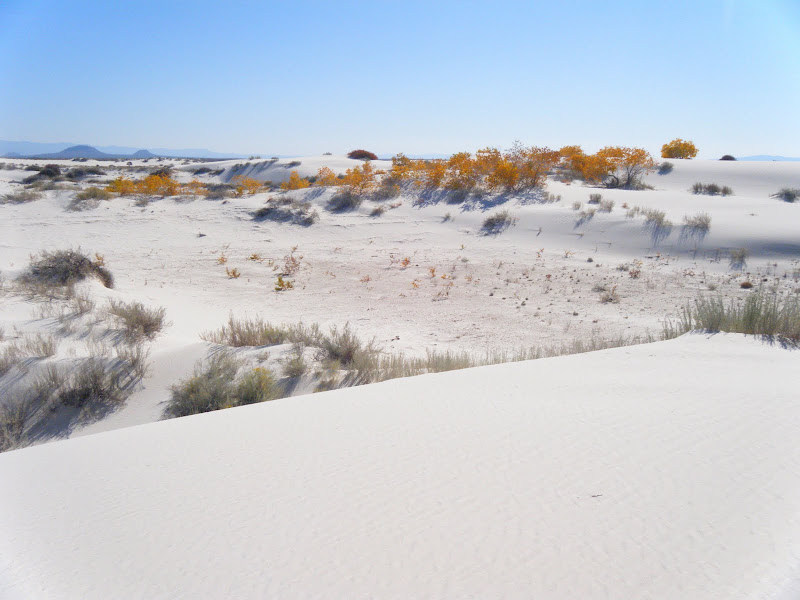
White Sands National Monument is located in the Tularosa Basin and surrounded by White Sands Missile Range, the site of the first atomic bomb test. The area is desolate and remote and still used for target practice. The dunes are composed of gypsum, a salt that accumulates in the dry lakes and playas of this closed basin.

From White Sands National Monument

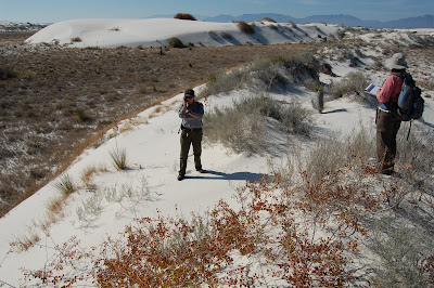
Our Mission: Vegetation mapping plus Search & Destroy Tamarix ramosissima AKA Russian Salt Cedar. Our goal was to ground-truth vegetation maps and locate populations of this invasive species for possible future air strikes.
From White Sands National Monument

Cottonwoods grow in the dunes because of the shallow water table.
From White Sands National Monument

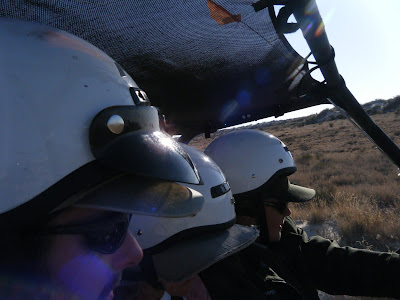
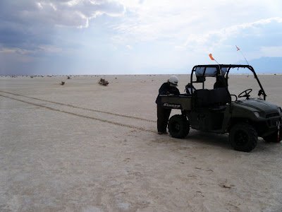
We traveled by sand buggy.

From White Sands National Monument


From White Sands National Monument
Many dunes are stabalized by Rhus Trilobata (Skunkbush Sumac), Poliomentha (Rosemary Mint Bush), Chrysothamnus (Rabbitbrush, Chamisa), and Yucca.

From White Sands National Monument
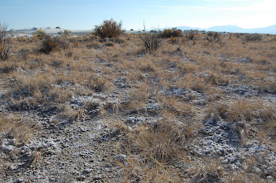
Tamarix ramosissima visible in the background. The foreground is covered by a thick salt crust.

Monday, October 26, 2009

Mesquite Treatment Monitoring in Lesser Prarie Chicken Habitat

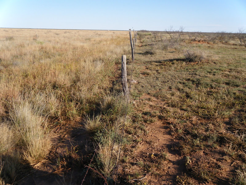
Mesquite has invaded large areas of warm semi-arid grassland, possibly due to a combination of land use and climate change. Fenceline contrasts usually indicate selective growth is due to land use; in the case below the field on the right is grazed while that on the left is a Conservation Reserve former farm field.
From Milnesand, NM
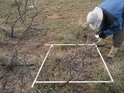
The mesquite has been sprayed with a selective herbicide in order to increase forage access for cows. Our goal was to monitor the vegetation changes associated with mesquite die-off. I also observed that mesquite and other shrubs clearly stabalize more eolian transport than do grasses.

Yvonne: "looks like pretty good kill to me. I don't know what he's complaining about. You never get 100% -- not in nature"
Rancher: "never seen it this green this time of year before"

--

lark buntings dance from mesquite to mesquite
trilling as they fly: pipsqeek joy
horsecrippler cactus
we dug and boxed for home

From Milnesand, NM
two Great Blue Herons flap-float overhead
bringing/bearing profound stillness
tarantulas still crossing road
honk/gurgle of sandhill cranes float out
of clear blue sky

From Milnesand, NM

Damn scorpions - one just crawled under fridge
pocket gopher diggings everywhere!
Panicum obtusum, virgatum
spider webs shimmer parachute? balloon?
Look! a tiny spider clutching the tiptop of a tiny Buchloe grass
it flies away, and for a moment; Pure Magic

From Milnesand, NM
12:30 2 groups of 3 and 4 cranes, circling overhead
another group of 2 joins them
we hear them long after they are lost in sky
their presence gives it dimension, then dimensionless

From Milnesand, NM

Sunday, June 15, 2008

Colorado Natural Heritage Program (CNHP)

"For in the end, our society will be defined not only by what we create but by what we refuse to destroy." Every state in the U.S. has a Natural Heritage Program (NHP) to comprehensively and systematically monitor biological diversity.
Colorado's NHP GIS computer models select points of special interest based on aerial and satellite imagery. We follow GPS maps to the sample point,
lay out plots to focus our attention at different scales from the microscopic to the landscape.,
collect plant specimens and soil samples as well as analyze ecosystem processes and integrity:
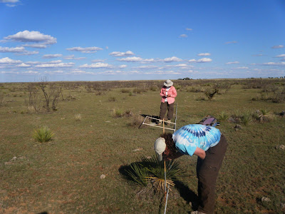
Long summer days in the field.

Sunday, October 21, 2007

Endangered: Pima Pineapple Cactus

This expedition, led by Patrick Dockens of EcoPlan Associates, traveled beyond the mine tailings of Green Valley and skirted the variegated edge of the beautiful Sonoran Desert to map the homeland of the rare & Endangered Pima Pineapple Cactus (PPAC). The PPAC is named for its shape, not its taste, and is primarily threatened by the voracious appetite of development & accompanying habitat destruction.

This quite large mother is shown carrying a single "pup" (at bottom of photo), a vegetatively propagating bud. The really cool thing about these surveys is that they provide an excuse to thrash around in the prickly heart of the Sonoran desert. Unless science mandates straight-line transects for statistical rigor, few would dare to brave the physical rigors of the desert for days and weeks on end. This labor bore the fruit of knowledge: we located several isolated populations of the Pineapple, and since we had also observed many places without populations of the cactus we began to form an idea of the microclimate and plant associations that the Pima Pineapple Cactus favors. Although it is only a hunch or an intuition, I believe that the members of this field crew are probably now better able to find this cactus than are any other people on Earth.

I wonder if this intuition could be quantified....here is an effort to use non-hypothesis-based factor analysis to do just that in the Colorado Rockies.