Showing posts with label colorado. Show all posts

Thursday, August 06, 2026

Tundra Communities at Rocky Mountain National Park

Hiking the tundra communities trail in Rocky Mountain National Park I appreciated the classic engraved interpretive signs.  Even better, the text is almost poetry!


The alpine tundra is a land of contrast and incredible intensity, where the sky is the size of forever and the flowers the size of a millisecond. - Ann Zwinger

Land Above the Trees. You are entering a special world. Life here is strained by scouring winds and bitter cold, and only the hardiest survive.

The march of forests up the mountains is abruptly halted by cool summer temperatures. At their upper limit, trees may grow only an inch in diameter every one hundred years. On the tundra, snow can fall any day of the year. Nighttime temperatures often dip below freezing. Only plants adapted to this harsh environment can surviye where the growing seasons last six to eight weeks each year.

Each winter, hurricane force winds in excess of 100 miles an hour drive snow across the tundra. Thirty foot drifts form in places, covering plants and animals with a protective, insulating blanket. Where snow is blown free, the winds rob heat and moisture from vegetation and blast every exposed leaf and twig with particles of ice and sand.


In the distançe, the tundra appears unvaried and uniform. But closer inspection reveals an intricate patchwork of alpine plant communities. These were created by differences in snow cover, moisture, and soils. Unless disturbed, this thick turf of grasses andsedges will remain unchanged for hundreds of years.

Many alpine plants contain anthocyanin, a chemical “antifreeze" that converts sunlight into heat. Plant hairs provide a furry coat that reduces the loss of heat and moisture. These hairs also protect plants from the intense ultraviolet radiation that is twice what it is at sea level.

Winter winds sweep this fellfield or "field of stone" free of snow. This alpine desert may therefore receive as little as two inches of moisture each year. Dense cushion and mat plants survive best here; their moisture-seeking roots penetrate four to five feet into the rocky ground.

In wet areas, buried rocks are churned about as moist soil repeatedly freezes and thaws. Rocks are squeezed to the surface, where they form rock streams, stripes, garlands, or polygons.

Ice shaped Trail Ridge, even though glaciers never reached thishigh. The ground beneath your foet was permanently frozen during the Ice Age, and only the surface layers thawed in summer, Water trapped in the earth above the ice caused the supersaturated soil to creep down the mountain in ridges, or solifluction terraces.


In wet areas, buried rocks are churned about as moist soil repeatedly freezes and thaws. Rocks are squeezed to the surface, where they form rock streams, stripes, garlands, or polygons.

These gentle, rolling mountaintops are remnants of an ancient plain, lifted into the sky by tremendous mountain building processes. Rivers of ice a thousand feet deep once filled Forest Canyon to your right.

Glaciers ripped away the rock, widened the valley, and quarried the basins now filled with alpine lakes.

Lichens also help erode rock. These multicolored miniature plants produce weak acids that gradually dissolve the cement binding minerals together. They are one of the first plants to pioneer an area after glaciers retreat. Some species live for thousands of years.

White-tailed ptarmigan are also supremely adapted to alpine climates. These chickenlike birds have feathered feet that act as warm snowshoes. Ptarmigan often wait out winter storms in miniature snow caves. Their ability to turn white in winter and mottled brown in summer makes them masters of camouflage.

If you're quick, you may catch a glimpse of small, rabbitlike animals scurrying among the boulders. Pikas are the farmers of the tundra. They harvest plants: throughout the summer and store them in "haystacks" under rocks for their winter food supply. Deer mice, meadow voles, shrews, pocket gophers, and weasels are other small dwellers of this community.

Wednesday, September 24, 2008

Great Sand Dunes Vegetation Mapping

Merlin Enthralled (Richard Wilbur)
From GRSA

In a while they rose and went out aimlessly riding.
Leaving their drained cups on the table round.
Merlin, Merlin, their hearts cried, where are you hiding?
In all the world was no unnatural sound.
From GRSA

Mystery watched them riding glade by glade;
They saw it darkle from under leafy brows;
But leaves were all its voice, and squirrels made
An alien fracas in the ancient boughs.
From GRSA

Once by a lake-edge something made them stop.
Yet what they found was the thumping of a frog,
Bugs skating on the shut water-top,
Some hairlike algae bleaching on a log.
From GRSA

Gawen thought for a moment that he heard
A whitehorn breathe "Niniane." That Siren's daughter
Rose in a fort of dreams and spoke the word
"Sleep", her voice like dark diving water;
From GRSA

And Merlin slept, who had imagined her
Of water-sounds and the deep unsoundable swell
A creature to bewitch a sorcerer,
And lay there now within her towering spell.

Slowly the shapes of searching men and horses
Escaped him as he dreamt on that high bed:
History died; he gathered in its forces;
The mists of time condensed in the still head
From GRSA

Until his mind, as clear as mountain water,
Went raveling toward the deep transparent dream
Who bade him sleep. And then the Siren's daughter
Received him as the sea receives a stream.
From GRSA

Fate would be fated; dreams desire to sleep.
This the forsaken will not understand.
Arthur upon the road began to weep
And said to Gawen, "Remember when this hand

Once haled a sword from stone; now no less strong
It cannot dream of such a thing to do."
Their mail grew quainter as they clopped along.
The sky became a still and woven blue.
From GRSA

Sunday, September 14, 2008

Restoration at Coolbroth (Hell's Gate) Fire

From Forest Fire at Hell's Gate,


"The chainsaw work that took place recently on the Coolbroth site was in
response to the erosion issue and debris slide that closed the Coolbroth
road, following the storms in August. Trees were fallen, in contour with
the slope, in an effort to stabilize the hillside and avoid any further
slides that would impact the road. While the road will require some
further maintenance, it's been determined that the hillside has been
stabilized and should withstand any further storms. The treatment was
targeted in just those areas that were thought to be a threat to the road.
The remaining area will remain untreated, in order for the natural
ecological post fire processes to take place."

Kent W. Smith
Acting District Fire Management Officer

Monday, August 04, 2008

Upper Rio Grande Watershed: Rio de los Pinos to Conejos River


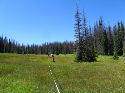
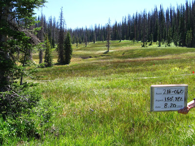
Flanked by the Conejos River and Rio de los Pinos, this watershed includes Pinorealosa and Osier Mountain, along with many excellent creeks (named and unnamed), alpine meadows, and river bottoms. Controlled burns and selective logging seem to be keeping the woodland open and healthy, while fire or beetles have left enough dead and downed timber to create unnavigateable thickets, quite conducive (necessary and sufficient) for unfragmented, Wilderness landscape.

Thin, filamentous, and/or deeply pinnatifid leaves, everything with prickles, spines, or a dense covering of hair (tomentous) -- but not many poisonous. Hairs serve to insulate as well as defend. ... In the wetlands, poisonous and fleshy plants dominate. Elk and bear, fire and grazing, Rorippa, Mimulus, Penstemon, Geum, myriad rodents scurrying away in all directions, fawns hiding breathless in the grass, hellebores and corn lilies, the 'Umbel of God', ululation, mountain thunderstorms...

The coastal fog of California, gentled by a 1,000 miles travel. I heed the thunder, and elevate the advent of rain above dull annoyance. This morning, I climbed the cliffs above our campsite. When I reached the top I felt like crying. Don't know why. Looking out over the watershed I understand the pattern. All water runs downhill. There is a band of trees from a lower line where it is wet enough to grow to an upper line where it is too cold to grow. There is a line in-between those two, above which precipitation exceeds evaporation. All rivers originate above this line, in their Headwaters.

I was always thinking of new, clever, ways of getting ahead of Nature, ahead of myself, beyond lightspeed and Saturation, entropy, Capacity. Rainbows multiplying from the first: Asgaard, Bridge to Heaven. But why does it curve back to Earth? Everyone sees a different shape and distance, depending on their perspective. The kind of rain mosquitoes can still swim through to sting. Lightening and that particular sound of the thunder rolling off of the peculiar and idiosyncratic topography up-valley.

But what if the world refuses to be ordered by the human mind? We know honeybees can be trained to show preference between human faces, but will they ever understand them? Then how too will we ever understand our world? Words are useless if we rely on them to a fault, if natural variation is continuous and nonlinear, yet we expect it to conform by our contingent, evolutionarily-derived logical architectures and cognitive biases.

On the backbone of the continent, the Genesis of the Southwest; a looking-glass world, mountains in every direction, but the brooding presence of the Great Plains felt in the passes opening between. At times we thought we were in Kansas, or safe away in our beds dreaming, but we were in the San Luis Valley, ripening in the sun.

You have driven up and down the mountain valleys, the flanks that lead up from below or down from above, the highways and streams of rivers and clouds. You have stood, still, in the center of the valley, under Blanca, for days. Transfixed interest, blossoms like dollar bills in the breeze. You have climbed high up where there is more air than land, yet still cannot seem to breathe enough and the mountain says enough and the Thunderstorm says Enough and you flee their mutterings and grumblings

Storms billow on surrounding mountains, then range over the landscape. Powerful rain, thunder and lightening on into the night...sigh... San Juan rainstorms. The next day the storms grow but, despite our hurry to avoid them, only blow for early Evening Entertainment, and on into the night. Next day, storms brush by, delivering a soaking with bits of hail mixed in. These storms build on the San Juans, blow low over the valley --but nothing can slow them until the Sangres, where they slide silently up the crest, lick their salty skins, run a tongue along sharpened teeth, and watch the wounds of mankind's world.

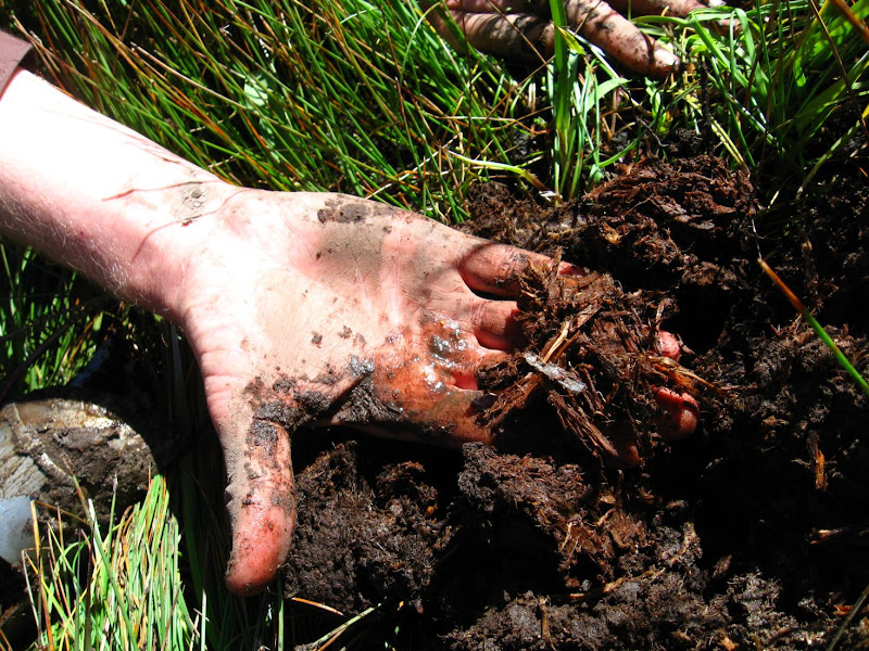
Where have all the willows gone? The heart of the landscape dug out, munched, passed, trampled dirt. The magic and will to live that flowed wild, healthy, worshipful. Destruction AND Growth. Unsimplified. Wet, unique.

All land in the West is "wetland"; fear not. Although nothing fits into categories anyway, each consciousness, attuned to an unique understanding, attempting an unbiased account of who-knows-what for someone else. Under the roof of the world, wet with the aspen, the carex, and the rivers; mountain ridges diverge until they peter out, rivers seek their breathren and converge until they become one with the ocean. Flowing water flows together - it lubricates itself; whereas water soaking into sponge, expands -- it flees the mutual weight of multitude.

Oh now gentle rain, Conejos River hopping along...who understands?

Saturday, August 02, 2008

Great Sand Dunes National Park

In Colorado, the elemental forces of the desert and mountains meet: wind, dominant in the scoured aridlands, here locked in struggle with the water of the alpine mountains. There is a line above which precipitation outweighs evaporation and it is from these lands that all rivers flow.
Wind picks up the sand and deposits it in a crook of the mountains arrayed about, who in turn let down the flow of the headwaters of the Rio Grande, great snake that cuts through a thousand miles of canyonlands to reach the Sea. The flow smooths the land incessantly like an overprotective mother.


Here is my high water mark, from whence I, too, will flow back to the desert. I have found the headwaters.

Wednesday, July 30, 2008

Workshops with Bill Zeedyk


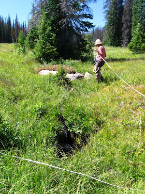
The problem contains the solution:
an old fence line
combined with cattle walking it
started erosion: headcuts usually go in 2's or 3's with soil horizons
you can see the O, A, and B horizons
the old fenceposts make an excellent sponge/step down
allow the water to trickle down
Starve the headcut with a "worm ditch"
set at 1/2 the slope of the hill
with a rope twice as long


Comanche Creek, Zapata Ranch, and San Luis Lakes

Saturday, July 26, 2008

Tuesday, July 08, 2008

Geology of Carnero Canyon

The Map Room. This is where most of our adventures start.
View up Carnero Canyon toward Hell's Gate, beyond which lies our cabin.
There is pillow lava here, scattered about, but especially in the next canyon over.
Penitente Canyon and the view toward the San Luis Valley and Sangre de Cristo Mountains.
Awesome columnar jointing on the South side of the Hell's Gate
North Side.

Back side.