 |
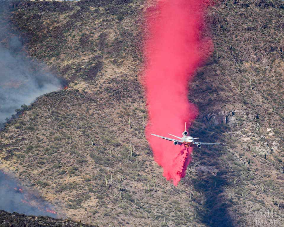
| Air tanker drops retardant ahead of fire. Photo by JDH images. https://wildfiretoday.com/tag/bush-fire-in-arizona/ |
Air tankers were extensively used in the initial attack on the fire, and Google Earth images of the fire start location show some interesting features. These images were taken on June 20, 2020, 7 days after the fire had burned this location.

The fire started on the West side of 87. Fire retardant strips are visible in several locations.

Where the fire was backing against the SW wind, retardant drops were successful in stopping the spread of the fire. A small bulge near the top of the image shows where fire crossed the line, but was contained.

Retardant drops on the south side of the fire were not successful in stopping the fire, but may have been instrumental in slowing the fire which allowed it to be stopped at the dirt road.

Retardant drops directly in front of the wind-driven fire were not successful in holding against the onrushing flames. The fire spread over and around the retardant line in this image.

No comments:
Post a Comment