A recent post by Scientific American writer and blogger John Hogan got me thinking about Bayesian statistics again.
My favorite explanation of Bayesian statistics was by Nate Silver in The Signal and The Noise. The basic approach involves incorporating prior estimates of probability into new measures of probability. The opposing approach, which does not rely on prior knowledge, is termed "Frequentist" statistics and is exemplified Fisher's standard test used with p=0.05 (which implies that a given result would occur "by chance" only 5 in every 100 such tests).
Hogan uses the standard example of cancer tests to illustrate the importance and power of Bayesian thinking, but an astute commenter points out that the real power of Bayesian thinking comes when used in a process that tests, updates probabilities, and tests again, so that each test incorporates the learning from previous tests.
Silver offered a similar example in his book, but a review in the New Yorker points out that Silver got it wrong. In Silver's case, he applies Bayesian statistics to the probability that global warming is occuring. But the prior probability is estimated, and Bayesian approaches only improve on standard statistics when prior probabilities are well known. So while Silver does present a rational means of updating beliefs, since the original belief is not based on statistical data, the resulting analysis cannot be called statistically valid.
Both the New Yorker review and Hogan's thoughts highlight the inherent power of confirmation bias to trump any statistical test, even Bayesian tests.
Monday, January 04, 2016

Friday, January 01, 2016
Top Conservation of Stories of 2015
Looking back on the year, I feel that victories and gained ground made good News: US Congress acting(!) to ban microbeads, Supreme court upheld Clean Power Plan to reduce emissions of mercury by 1,000 million tonnes and thereby save more than 1,200 lives/year. CO2 reduction plans from the 2015 Paris COP 16. Administrative action to create a new office of ecosystem service financing (read: more support for restoration) and to standardize and promote mitigation banking.
However, there were some problems. The gargantuan natural gas leak in S. Ca. highlighted the fact that natural gas leaks way too much to be a clean bridge fuel. We either need to clean up natural gas or resolve to skip over it altogether.
However, there were some problems. The gargantuan natural gas leak in S. Ca. highlighted the fact that natural gas leaks way too much to be a clean bridge fuel. We either need to clean up natural gas or resolve to skip over it altogether.
Tuesday, December 22, 2015
A New Precipitation-Evapotranspiration Index to Map Global Drought
Standardized precipitation–evapotranspiration index (SPEI) is precipitation minus potential evapotranspiration (Vicente-Serrano et al 2010). It is distinguished from other drought indices because it accounts for temperature through modelled evapotranspiration. This website maps global drought:


Drought in the US 2010-2011.
SPEI has recently been used to predict pine mortality in SW forests. When the SPEI is below -1.68 for at least 11 months, pinyon and ponderosa pines cannot grow and mortality soon follows. (Kolb, T.E., 2015. A new drought tipping point for conifer mortality.Environmental Research Letters, 10(3), p.031002.)
 |
| Long-term drought graph for NM. |
Friday, December 18, 2015
2015 New Mexico Weather Recap
The ABQ NWS office has an excellent recap of the state's weather over 2015. For example, here is their summary of the summer monsoon:
The biggest news of the year was probably the good precipitation that finally ended the drought that began in early 2011:
| The 2015 monsoon season got off to a quick start with heavy rainfall, floods, flash floods and severe weather in mid and late June, as well as the first two weeks of July. A relatively quiet period ensued for most of the remainder of July. A resurgence of heavy rain returned from very late July through early August. An outbreak of severe weather was the dominate weather story in mid August, and to a lesser extent on September 9th and 23rd. | ||||||

By the numbers: The Albuquerque NWS office issued 53 flash flood warnings between June 15 and September 30.
|
The biggest news of the year was probably the good precipitation that finally ended the drought that began in early 2011:
Drought conditions developed across New Mexico in early 2011, with few breaks in the drought through 2012, such that much of the state was gripped in the worst drought episode since the 1950s. Near normal statewide precipitation in 2013 and 2014 did little to improve the drought. Much of the precipitation in 2013 and 2014 fell during the monsoon season, rather than the much more needed winter mountain snowpack.
Finally, New Mexico precipitation in 2015 was above normal for much of the year, and the period January through November was the fifth wettest on record since 1895. As shown in the graph to the right, precipitation in New Mexico was well above average in January, May, July and October, with only two months below average - August and September. These wetter than normal conditions supported a steady reduction in the intensity and coverage of the short term drought. Finally, in early December 2015 New Mexico was drought free! The last time the state was without any drought status was the week of November 23, 2010!
By the numbers: New Mexico went 263 weeks with a portion of the state in moderate or worse drought!
|  | |||||
 | ||||||
| Source: U.S. Drought Monitor | ||||||
Tuesday, November 17, 2015
A model of Ecosystem Monitoring to inform Adaptive Management


Lininger, Jay. 2006. Effectiveness of Stand-Scale Forest Restoration in the Siskyou Mountains, Oregon.
NEPA Impacts Now Require Mitigation
President Obama has recently issued an important new Memorandum directing Federal agencies to employ mitigation banks to offset impacts to natural resources.
The directive re-emphasizes that agencies should seek to avoid any negative environmental impacts first, then minimize impacts, and finally, only seek compensatory offsets for harm that still occurs if necessary. Within the limits of existing law, agencies should set ‘no net loss’ and ‘net benefit’ goals that apply to more natural resources. (CEQ Blog Post)
The following analysis of the impacts of this memorandum are from the law office of Holland and Hart:
"We have entered a new regime in federal natural resource management, one that brings to mind Aldo Leopold’s observation that “Conservation . . . is a positive exercise of skill and insight, not merely a negative exercise of abstinence or caution.” In time, we will have a better sense of what the new regime will mean in practical terms. For now, the natural resource community will want to focus on the various agencies’ efforts to implement the directives. Across the federal government, for months to come, new rules and policies will be under development with implications for an enormous range of decisions affecting natural resources “that are important, scarce, or sensitive, or wherever doing so is consistent with agency mission and established natural resource objectives.”
These directives deserve considerable attention from those active in the natural resource law and policy arenas. There are new rules of the road for resource agency decisions subject to NEPA review, and they may significantly influence implementation of ESA and other resource protection laws. Federal resource planning efforts will likely change to include substantial consideration of “net gain/no net loss” benchmarks. Most fundamentally, the new directives seem likely to change the transactional environment facing developers seeking federal approvals for: infrastructure projects; energy, water, and mineral development; or other activities potentially impacting federal natural resources.
Agencies’ permitting and compliance decisions involve significant elements of subjectivity and uncertainty. The permitting process is often defined by bargaining over the allocation of risk between an agency wary of potentially unforeseen resource impacts and a developer or resource user wary of potentially unforeseen costs or delays. The Presidential and DOI directives can be seen as ratifying and calling for even greater effort by resource agencies to minimize or eliminate the risk of unforeseen impacts on natural resources. In effect, the agencies are being told to bargain harder, demand greater assurances, and accept little or no risk of adverse impacts when rendering decisions potentially affecting natural resources.
The directives raise the bar, but are not entirely one-sided. They encourage agencies to promote conservation banking, stewardship contracts, and other financial-incentive-based tools that generate “credits” that developers can use to offset adverse impacts of proposed projects. The internal logic of the directives appears to be that the new, higher standards for resource mitigation—net gain, or at least no net loss—are realistically achievable because any project’s unavoidable adverse impacts can be offset with conservation credits.
The agencies’ mandate to bargain harder will create difficulties for almost all resource users. To begin with, baseline resource information often lacks the empirical certainty that would make it obvious how to get to a net gain or no net loss. And what is a “net gain”? How big must that be? More challenging, the directives call for “durability” in mitigation, meaning that the quantitative and qualitative relationship of impact to compensation should endure so long as the impact continues. But natural resources change over time. Even resources that once seemed static are now recognized to be mobile as temperature, precipitation, fire, and other variables change across the landscape. The new directives will particularly frustrate those resource users who are not inclined to anticipate nor internalize within their project planning and business judgments the agencies’ resource management goals. Whatever the agencies were bargaining for yesterday, they’ll soon be bargaining for more.
There is something encouraging here for those resource users who approach the regulatory environment with a transactional mindset. The directives’ embrace of compensatory mitigation means that, once the directives have had time to be incorporated into agency procedures, there should be a predictable regulatory “solution” for a project potentially posing the risk of adverse resource impacts. In theory, the ultimate decision about whether - and on what terms - to approve a permit or other authorization should be somewhat less vulnerable to an agency official’s reluctance to countenance unavoidable adverse resource impacts. This is particularly so if the agencies do, in fact, embrace the use of mitigation banks and other credit-generating tools.
The other potential winners from the directives will be private investors in mitigation banks and similar financial structures that produce resource “credits” to exchange for impacts.
Tuesday, October 13, 2015
Analysis of Soil and Vegetation Maps:
Accuracy and Utility for Describing Actual Habitats
There are four sources of landscape information from maps at
the project level a few miles on a side. Topogaphic maps, satellite maps, soil service
maps, and vegetation maps.
Comparing soil and vegetation maps at this scale is
complicated by inaccuracies of both map sources and the strange ambiguity of
aerial photography. Soil was mapped by
NRCS into 6 major soils. However, two of
the soils are described as compound soils, regions of undefined patches possibly
intergrading continuously into one another.
For example, Pyote-Maljamar soils (PU on soil map) have a layer of fine
sand everywhere, but there are unmapped bits and pieces of caliche at around 50
inches (Maljamar soils) in a matrix of deep sand (Pyote soils).
 |
| Soil map created using the NRCS Web Soil Survey showing major soil types. PT and PU are deep sands, BH and KO are shallower silty soils, and TF is intermediate. (PA and BA are extensions of PT and TF, respectively, in Eddy county.) |
Soil Profiles:
|
|
PT
|
PU
|
TF
|
BH
|
KO
|
||
|
|
Pyote
|
Pyote
|
Maljamar
|
Tunuco
|
Berino
|
Cacique
|
Kimbrough
|
|
0-10
|
A:
Loamy fine sand
|
A:
fine sand
|
A:
fine sand
|
A:
loamy fine sand
|
A:
fine sand
|
A:
fine sand
|
A:
gravelly loam
|
|
10-20
|
AC:
loamy fine sand
|
Btk:
sandy clay loam
|
Bt:
sandy clay loam
|
Bkm:
cemented material
|
|||
|
20-30
|
Bkm:
cemented material
|
|
|||||
|
30-40
|
Bt:
Fine sandy loam
|
Bt:
fine sandy loam
|
Bt:
sandy clay loam
|
|
Bkm:
cemented material
|
||
|
40-50
|
|
||||||
|
50-60
|
Bkm:
cemented material
|
||||||
|
|
Sandy eolian deposits
|
Sandy eolian deposits
|
Sandy eolian deposits
|
Sandy eolian deposits
|
Sandy eolian deposits over sandy
calcaereous alluvium
|
Calcaerous eolian deposits
|
Calcaerous alluvium and/or eolian
deposits
|
Selected Soil Properties
|
|
PT
|
PU
|
TF
|
BH
|
KO
|
|
Depth to restrictive layer
|
>200cm
|
127cm
|
43cm
|
>200cm
|
15cm
|
|
Calcium Carbonate (CaCO3)%
|
2%
|
2%
|
0%
|
17%
|
15%
|
|
% sand
|
75.8%
|
81.9%
|
78.6%
|
62.6%
|
43.0%
|
|
Ksat (inches/hour)
|
7.8
|
8.5
|
12.6
|
1.7
|
0.5
|
In this part of NM, depth to a restrictive soil layer
indicates the presence of caliche near the surface. These petrocalcic horizons are denoted Bkm on
the soil profile. KO has the shallowest
effective soil, followed by TF. Some
parts of BH appear quite shallow, but in the table the depth to a restrictive
layer is listed as greater than 200cm, possibly because some of the soil (i.e. the
Berino component) lacks a caliche layer. Caliche is composed of calcium
carbonate, so BH and KO are listed with the most calcium, and the least sand in
their profile.
Saturated hydraulic conductivity (Ksat) refers to the ease
with which pores in a saturated soil transmit water. The estimates are
expressed in inches/hour for ease of comparison to possible rainfall rates.
They are based on soil characteristics observed in the field, particularly
structure, porosity, and texture.
Restrictive soil layers and overall soil texture contribute
to the ability of a soil to drain water.
PT, PU, and TF are listed as very well drained soils because they can
all drain more than 7 inches of rain an hour, whereas BH and KO are
significantly less porous, draining only 1.7 and 0.5 inches of rain an hour,
respectively. Most of the water from
heavy rains probably runs off of these soil types, limiting the amount
available to grow plants.
Saturated hydraulic conductivity is considered in the design
of soil drainage systems and septic tank absorption fields. It probably has the
greatest impact on plant production of any soil parameter in SE NM.
 |
| Hydraulic conductivity is the rate at which a soil can absorb water. Red areas have the least ability to absorb rainfall, while blue areas have the greatest ability to absorb rainfall. Map created using NRCS Web Soil Survey. |
Vegetation Map
 |
| Vegetation map from USGS GAP Vegetation Mapper uses NatureServe Ecological System Classification. |
Vegetation Map Key and Attributes
Table 3. Vegetation Map Key and Attributes
|
Color
|
ReGAP
Community Name
|
Vegetation
Type
|
Dominant
Species
|
Accuracy
|
|
|
Great Plains Shortgrass Prairie
|
Grassland
|
Biennial wormwood, Russian thistle
|
Low – should be mapped as disturbed area
|
|
|
Mesquite Upland
|
Thornscrub
|
Mesquite, Catclaw Acacia, Mimosa, Yucca
|
High - mesquite dominant
|
|
|
Sandhill Shrubland
|
Shrub
|
Shinnery oak, Catclaw acacia, Giant dropseed
|
Medium – not all dune
|
|
N/A
|
Sandy Plains Semi-Desert Grassland
|
Grassland
|
Purple three-awn, Sand dropseed, Sand muhly
|
Low – not mapped
|
The GAP national land cover data, based on the NatureServe Ecological Systems Classification, are the foundation of the most detailed, consistent map of vegetative associations available for the United States. The soil map is interpolated based on soil pits and
vegetation patterns, so in a way it functions as a hand-drawn vegetation
map. Vegetation patterns have changed
from the time the soil survey was completed (1960’s?) to now. This GAP high-resolution vegetation map was
produced via satellite mapping and computer algorithms.
The prairies
of the southern Great Plains are also called the Llano Estacado, a region where
vast flat to rolling uplands are covered with blue grama grass. However, this
vegetation type is misclassified. GAP
maps roads and disturbed areas with low grass as shortgrass prairie (brown on
image) because these areas look similar to prairie in multispectral satellite
imagery. It maps the rest of the project
area as a fractal pattern of mesquite upland (mauve) patches and sandhill
shrubland (green) patches.
Mesquite has
spread throughout areas with deep sandy soils and now forms the default
vegetation community across much of the area. Mesquite can also invade sandhills
and desert washes and other coarse-textured soil areas. It is especially
invasive in grasslands such as Sandy Plains Semi-Desert Grasslands, Great
Plains Shortgrass Prairie, and Chihuahan Semi-Desert Grasslands.
Mesquite
grows best when soils are deep, lacking the caliche or clay pan that would
limit infiltration and storage of winter precipitation in deeper soils layers.
Mesquite and other deep-rooted shrubs exploit the deep soil moisture that is
unavailable to cacti or grasses.
The effects of major soil boundaries are evident: deep sand
(PT and PU) soils support more sandhill shrubland, whereas soils with shallow
restrictive horizons (BH and KO) tend to have more mesquite upland
patches. The vegetation map fails to
identify patches of Lehman lovegrass grasslands, or catclaw acacia shrublands,
but it does correctly identify shinnery oak areas as sandhill shrubland.
However, the map misses out on an important intermediate
community, sandy plains semi-desert grassland.
Sandy plains grasslands are actually the dominant community throughout
much of the project area. It is
distinguishable on the ground by the greater proportion of grass than shrubs on
sandy soils, often with Aristida purpurea, Muhlenbergia arenicola, and
especially Sporobolus flexuousus.
However, this community has been invaded by mesquite shrubs (some areas
of which have been recently killed with herbicides) so these grassland patches
can be difficult to distinguish from true shrublands.
Topo Map
A topo map shows that areas with accumulating sand are typically uplands, especially breaks in slope where winds drop eolian deposits. Eroding, exposed slopes reveal deeper, more-developed paleosoils, possibly
Pleistocene clays (Steve Hall, 2006 Geomorphology of Mescalero Sand Dunes).
On top of soil and geomorphic landscape-determined
vegetation patterns, local populations of invasive species have overlaid an
unpredictable pattern of monocultures of Lehman Lovegrass, Artemisia biennis,
and occasional plants of Salsola tragus around wellpads. Note that none of these invasive species are
NM state-listed noxious weeds. There are
also surprising areas of intact, diverse Chihuahuan grasslands with healthy
stands of black grama , muhly arenicola, and sporobolus cryptandrus. All of the sand dunes here, despite
presence of shinnery oak, and even some Artemisia filifolia, are coppice or hummock
dunes that formed around shrubs during historical time (Hall, 2006).
Appendix: Soil Properties Maps
Depth to a restrictive soil layer:

Percent sand:

Percent calcium carbonate:

Friday, October 02, 2015
2015 Summer Monsoon Totals

The NWS maintains a report of monsoon totals for the ABQ metro area.
 |
| Percent of normal monsoon moisture received in July, August, and September 2015. |
 |
| Moisture during the summer was spotty, but usually above average. |
Wednesday, September 16, 2015
Roadsides Provide Critical Habitat for Pollinators
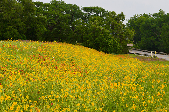
"Over the past 18 months, support for pollinators has undergone a seismic shift, led by President Obama, who called for a national Pollinator Task Force in the spring of 2014. Less than a year later, in a book-length "Strategy to Protect the Health of Honey Bees and Other Pollinators," the federal government set ambitious goals that include the restoration or enhancement of 7 million acres of land for pollinator habitat over the next five years. Roadsides will comprise a significant portion of that acreage..."
Read the rest of the article.
Thursday, September 10, 2015
Xenotopias
We lack –we need—a term for those places where one experiences a transition from a known landscape into new country or another world: somewhere we feel and think significantly differently.
I have for some time been imagining such transitions as ‘border crossings’. These borders do not correspond to national boundaries, and papers and documents are unrequired at them. Their traverse is generally unbiddable, and no reliable map exists of their routes and outlines. They exist even in familiar landscapes: there where you cross a certain watershed, treeline or snowline, or enter rain, storm, or mist, or pass from boulder clay onto sand, or chalk onto greenstone.
Such moments are rites of passage that reconfigure local geographies, leaving known places outlandish or quickened, revealing continents within countries.
What might we call such incidents and instances – or, rather, how to describe the lands that are found beyond these frontiers? I suggest the term ‘Xenotopias’, perhaps, meaning ‘foreign places’ or ‘out-of-place places’, a term to complement our ‘utopias’ and our ‘dystopias’.
[A quotation from Robert MacFarlane's The Old Ways]
Subscribe to:
Posts (Atom)