Wednesday, October 02, 2013

What does a natural forest fire look like in the Southwest?

What is "natural"?  Ecologists use the range of natural variability to define proper functioning condition (PFC) or minimally disturbed condition (MDC), etc (in the jargon of ecologists -- basically, what was it like before we mucked it up?)  The question is surprisingly hard to answer.

Tom Swetnam has been quoted drawing a distinction between burn severity (high-intensity burns are natural) and extent (but high-severity burns across large landscapes are not natural).  These statements are part of an ongoing debate that, like many debates in ecology, may be dependent on local factors.  

In Arizona, Dr. Wally Covington became famous for championing open park-like Ponderosa forests.  Indeed, many landscapes are dominated by frequent low-intensity grass fires that clear out underbrush and young trees.  But at longer time scales it seems equally clear that these same forests can catastrophically burn.  This has been pointed out by Dr. Baker's work in Arizona, and by Dr. Grant Meyer in Sacramento Mountains of New Mexico.  More evidence is not hard to find.  For example, a study of the geomorphology of the Rio Cebolla river in the Jemez Mountains noted extensive sediments with large burned logs indicative of high severity fire in what must have been extensive headwater areas. 

Dendrochronologists  often focus on the last 1,000 years, whereas geomorphologists have a much larger picture, often spanning not just this interglacial, but also the last several ice ages.  (CF Great Basin Riparian Ecosystems by Miller and Chambers et al)

Fires are transformative, but both more and less impactful than commonly thought.  They accelerate and are accelerated by climate change.  Most large fires are not as bad as news reports indicate -- they are bananzas for wildlife and fire-dependent trees and shrubs like aspen and oak.

Most "megafires" aren't really managed with a full suppression strategy, but a containment strategy -- still not 'let-burn' but pretty close.  Unfortunately, suppression and containment efforts can be as damaging as fire.  

Whether or not fires are natural, the inevitable question is raised as to whether humans can restore the environment better or faster than natural succession would?  This is a loaded question, because of the salvage logging controversy.  One logger expressed confusion about why thinning before a fire is justified, but salvage logging after isn't.  But either may be ineffective in preventing the next conflagration.  If ERC is high enough and there is enough ventilation, anything will burn, even the Olympic Peninsula rainforest! (Cf Dr. Gavin's ESA talk)

Friday, September 27, 2013

History and Philosophy of Science

The current AGW debate (new 2013 IPCC report versus skeptical community embodied in NIPCC and wattsupwiththat.com) mirrors the dynamic described in Leviathan and the Vacuum pump: two groups of men, both claiming to create knowledge and decide what is true for the rest of society.  One is composed of men of authority and credentials, the other composed of coffee-shop debaters and home-experimentalists.  In the 1600's,  the powerful men created knowledge to bolster the monarchy, while they feared the upstart debaters as crypto-revolutionaries.  Today, powerful scientists create knowledge to create societal demand for their power and knowledge, while they fear the "deniers".

(I first read Leviathan and the Vacuum Pump (about Hobbes' and Boyle's argument) in a History of Science course with Dr. Andre Wakefield at the Clarement Colleges.)


Wednesday, September 25, 2013

Staying Realistic About Prescribed Burns


"In my 30 years with the U.S. Forest Service, I've worked on a number of prescribed burns.  In recent years they have become a popular thing to do.  In the flurry of burning stuff, the question we need to ask is not, "how many acres should be burned? But rather, "did the burn have the desired effect?" If the fire was to remove fuels and burn dead logs, did it replace that heavy fuel with waist-high weeds, brush and grasses -- more dangerous flash fuels?

Fire can be an excellent tool, but I think there are other tools that better manage certain public lands.  There are some places that are too valuable to risk a blackened landscape."
-Bob Damson response in The Nature Conservancy's September/October 2013 magazine.

Friday, August 02, 2013

Under-reported Stable Fire, Jemez Mountains New Mexico

We have been getting some smoke the past couple weeks from an under-reported fire, about 5 miles West of Jemez Springs.  The Stable Fire was started by a lightening storm on Stable Mesa.  From radio traffic, it sounds like the Forest Service is using the fire as an opportunity to introduce low-intensity controlled burns (= forest restoration) to a few hundred acres of forest around the fire.  More info.

Wednesday, July 17, 2013

Friday, July 12, 2013

Regolith and Quarternary Sedimentology: questions to infer paleogeomorphology and paleoclimate

This image was taken along Las Huertas creek, near the village of Placitas.  Note the lack of developed soil horizons: the top layers appear to be unconsolidated colluvial debris.   Perhaps the sandstone layers below the Juniper roots are paleo-sand dunes?  What then might the different colors indicate?

This image and the following were taken along La Jencia creek, deeply incised into Pleistecene and Holocene sediments in the San Lorenzo Spring quandrangle west of Socorro, NM.    The layers exposed along the creek channel show darker clay and/or organic-enriched layers that may have formed from swamps and/or backwaters along paleochannels.
Screenshot of the Quandrangle geological map, with a red dot on La Jencia creek showing the location of the photos.
This exposure reveals an unconformity in the left-center that may be due to in-filling of a paleo channel?  Does this images show an actual unconformity, with deposition, then erosion, then deposition? Or was there continuous deposition? Why is there banding of light and dark material in such regular layers?  How were these layers laid down?  Does the fact that they were deposited indicate an aggrading landscape, perhaps controlled by climate-influenced sediment supply??

This photos shows a close-up of a tiny (5-foot long) layer of darker clay, clearly deposited in a concavity.  Note the coarser sediment deposited below it and the finer sediment above.  How old are these layers?  How do geologists infer the direction of paleoflow?  Why aren't there fossils?

Surface geology maps of the area offer confusing clues to interpreting these buried layers.  The geological map for the quandrangle to the North of San Lorenzo Springs (the Silver Creek quandrangle) shows paleochannel flows on the surface, as well as relictual dunes from some point in the Quarternary.  Why are the paleochannel flows going every which way?  Was this whole valley a closed basin, and if so, would that explain the aggradation, independent of sediment supply?  Why is this stream downcutting so rapidly today?  What are the implications for the future?

Riparian Restoration Quandary

Plants along rivers face a basic quandary: the closer to the channel they grow, the more water they have.  But, closer to the channel, there is more disturbance from flooding.

So:
  • Is this a healthy/unhealthy stream bank?
  • Is it in need of restoration?

It has:
  • invasive species
  • sparse vegetation
  • obviously eroding banks....

It might be important to ask: What is bankfull here? 

It might also be important to know that this is actually a dry wash, photographed after the first rain in 9 months...it looks grazed, and it is grazed.  By a herd of native Elk, forced out of the uplands by the worst drought in 50 years.

We have to be careful to set our ecological expectations to the history of natural disturbance and the reality of a changing climate.

Thursday, July 11, 2013

Gaillardia grandiflora

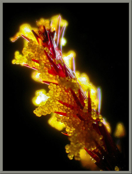
Photomicrograph of an Asteraceae stigma with yellow pollen grains attached.
From this website.

Friday, July 05, 2013

La Jencia Flash Flood!


Moving at about 5 miles per hour (as judged by floating tumbleweed), the front of the flood (visible here with lots of foamy flotsam) made a roaring sound easily audible at the ranch house.  The brunt of the thunderstorm had passed more than half an hour previous.  Based on cross sections of this reach, the flood was only about 30cm deep, and represented a flow of approximately 50 CFS.  This amount of water may be "bankfull": the bank-side sedges were underwater, the willow got their feet wet, and no major channel geomorphic changes occurred. 

Advancing front of flash flood.

 The next day.


 Flooding along old channel where side canyon empties in.  This channel was abandoned in 2009 when the creek cut through a meander bend.