
Wednesday, August 29, 2012

Wednesday, August 22, 2012
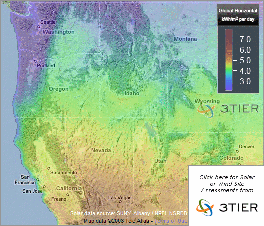
Plant OR Animal Distributions
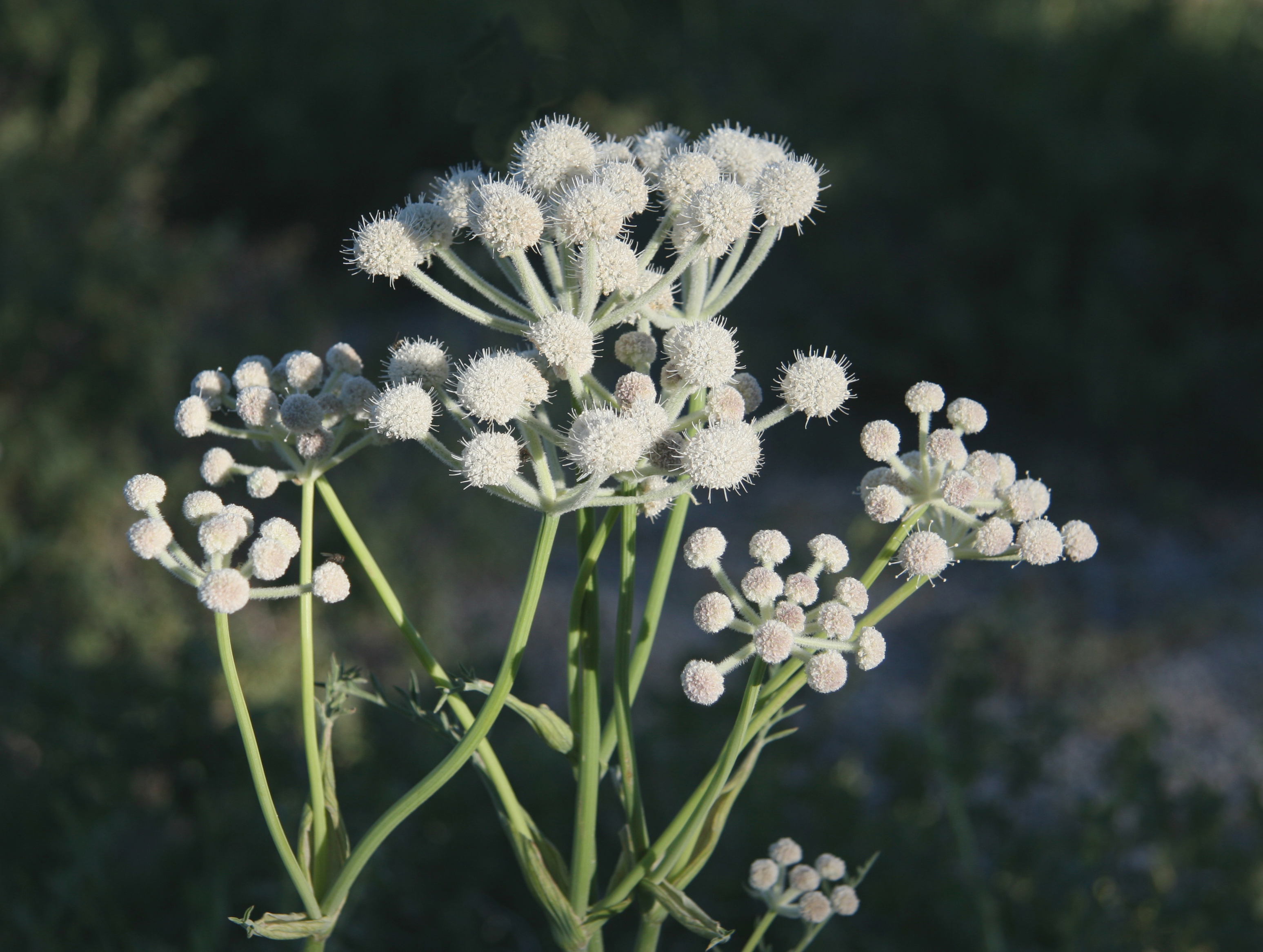
BOMAP has the best plant distribution maps, by county.
Sphenosciadium capitellatum:


The GAP program has the best vertebrate distribution maps (modeled).
American Pika (Ochotona princeps):


Sphenosciadium capitellatum:

The GAP program has the best vertebrate distribution maps (modeled).
American Pika (Ochotona princeps):


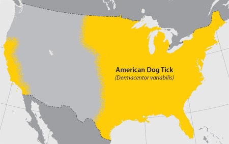
Apparently, there are ticks, everywhere
Best resource on identifying ticks:
http://www.cdc.gov/ticks/geographic_distribution.html


http://www.cdc.gov/ticks/geographic_distribution.html
Idaho Forest Fires
View of the Halstead fire in the Salmon-Challis National Forest on July 31st from SR-21.

Summer convective thunderstorms add only a small amount to the water budget of the Northern Rockies, and the fire season here typically picks up when evaporation greatly exceeds precipitation in the latter half of the summer.
Percent of normal precipitation, June 21st to August 21st:

from http://water.weather.gov/precip/
2012 has been a dry summer, and there are currently three major forest fires burning in central Idaho (from north to south): the Mustang Complex that grew out of the uncontainable Chrandal Creek Fire, the Halstead Fire Northwest of Stanely, ID, and the Trinity Ridge Fire Northwest of Anderson Ranch Resevoir and Pine, ID. This image from August 10th clearly shows the smoke plumes from these three megafires, which have each burned nearly 100,000 acres of forest so far, with no end in sight.

Craters of the Moon National Monument lavafields are visible in the lower right corner, Boise is in the lower left, Lake Cascade and McCall are in the center left, and Montana is just visible in the upper right.

Percent of normal precipitation, June 21st to August 21st:

from http://water.weather.gov/precip/
2012 has been a dry summer, and there are currently three major forest fires burning in central Idaho (from north to south): the Mustang Complex that grew out of the uncontainable Chrandal Creek Fire, the Halstead Fire Northwest of Stanely, ID, and the Trinity Ridge Fire Northwest of Anderson Ranch Resevoir and Pine, ID. This image from August 10th clearly shows the smoke plumes from these three megafires, which have each burned nearly 100,000 acres of forest so far, with no end in sight.

from http://activefiremaps.fs.fed.us/
Tuesday, July 24, 2012


Saturday, July 21, 2012

Wednesday, May 02, 2012
Disturbance is good for productivity

Monday, April 30, 2012
The Future of Forests...is People
David Wear, USFS, predicts large declines in forest area in the US as
more and more land is developed for housing. Over the next 50 years the
US population is forecast to double again to 500 million, mostly along the
coasts.

Most of the RPA interval projections by the USFS are driven by economic analyses. Increased wealth greatly increases the impact of any increase in human population, because wealthier people build bigger houses, shop more, and need more roads. More people will need more food, leading to higher food prices that threaten to undo the conservation reserve program, putting reforested land back into food production. But higher prices for timber or biomass would actually increase forested area! With a higher value on trees, timbered lands might be worth too much to develop....
I conclude that the US needs a healthy forest products (including, somehow, forest biomass) industry to push back against the teeming urban hordes.
Most of the RPA interval projections by the USFS are driven by economic analyses. Increased wealth greatly increases the impact of any increase in human population, because wealthier people build bigger houses, shop more, and need more roads. More people will need more food, leading to higher food prices that threaten to undo the conservation reserve program, putting reforested land back into food production. But higher prices for timber or biomass would actually increase forested area! With a higher value on trees, timbered lands might be worth too much to develop....
I conclude that the US needs a healthy forest products (including, somehow, forest biomass) industry to push back against the teeming urban hordes.
Thursday, April 12, 2012
Finally, after months of waiting, Thursday, April 12 was burn day at Mason Farm Biological Reserve.
 It has been very dry here and Tuesday was a Red Flag day, but Thursday dawned cool and not-too-windy.
 A little bit more wind would have been helpful to oxygenate the burn more. Trees have already leafed out, decreasing below-canopy advective and convective air movement.
 There were no problems with the fire lines, and the burn was finished by 5 PM.
For more information about natural fire regime in Southeastern Piedmont forests:


For more information about natural fire regime in Southeastern Piedmont forests:
Frost CC, Walker J, Peet RK. Fire-dependent savannas and prairies of the Southeast: original extent, preservation status, and management problems. Wilderness and natural areas in the eastern United States: a management challenge. Nacogdoches, TX: Stephen F. Austin State University, School of Forestry, Center for Applied Studies. 1986:348–357.
Subscribe to:
Posts (Atom)