Monday, November 16, 2009

La Jencia Restoration Project Evaluation after 10,000 CFS Summer Flood


"No characteristics of the channel provide indication of why some reaches scoured when the rest of the reach filled ... When there are a large number of interrelated factors which must adjust among themselves in response to occurrences in the environment, such as storms or flows, it should be expected that there will generally be an indeterminacy in the manner of this mutual adjustment.... Where a particular factor dominates, such as a bedrock floor of a channel, the effects of this factor may be readily evident. However, where the alternatives become more nearly equivalent it becomes more difficult to specify the precise form in any give case...This indeterminacy in a given case results from the fact that the physical conditions, being insufficient to specify uniquely the result of the interaction of the dependent variables, are controlled by a series of processes through which any slight adjustment to a change imposed from the environment feeds back into the system." (Leopold, Wolman, Fluvial Geomorphology. describing the equivocal results on their study of the dry wash (ephemeral channel) near Santa Fe, NM Arroyo de los Frijoles:)

From La Jencia Assessment Fall 2009

Context:
La Jencia Ranch is located near the continental divide, west of the Rio Grande, north of the Magdalena mtns at about 5500 feet in a broad almost-closed basin composed of Pleisticene-sediment. Springs feed an intermittent reach in what is otherwise an ephemeral system. The watershed above this point is approximately 350 square miles, and large bursts of storm water have contributed to massive erosion in this area. By anecdotal reports, this entire canyon system (with 100+ foot walls) has cut in the last 120 years since Anglos homesteaded in the 1880s. This report is corroborated by the evidence of recently rejuvenated side canyons and active headcuts.

A continuing riparian restoration project has been focused on planting trees throughout the developing floodplain and meander cutoffs near ranch HQ. The continued lateral and vertical (down-cutting) erosion in the canyon is a management concern.

In the storm of 2006 a number of major hydrogeomorphic changes took place, notably the cutoff of several large meanders. This had the effect of significantly shortening and steepening the main channel. In a ~10 foot flood this September, another large meander was cutoff, in addition to significant erosion (and deposition) in other parts of this very dynamic system.
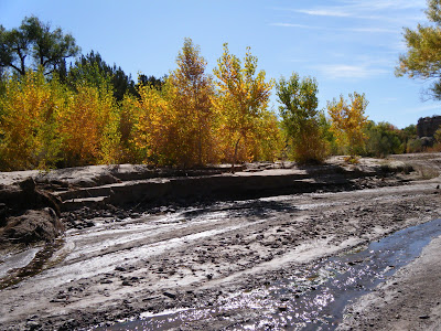
From La Jencia Assessment Fall 2009

Observations:
scoured out or deposited feet of sediment on benches cuts some places, stable others
looks like it wants to meander morehas active floodplain
flood was 6-10 feet high
widened in some places
in other places sedges and willows in middle survived
large meander cutoff downstream of house

General Conclusions:
did not downcut (degrade) during this flood, contra the 2006 flood. While an over-meander did cutoff as could be expected, it did not create a headcut, as was feared.

stream has access to floodplain. some deposition and scour over this surface is natural. La Jencia is a high-disturbance system.
NOT Down-cutting, and possibly AS GOOD AS IT GETS
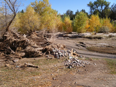
From La Jencia Assessment Fall 2009

Caveats: It is important not to be drawn into individual cut banks, but rather to evaluate the system on a whole.; "the failure of some in stream willow plantings (ISWP) does not invalidate the concept". In fact, some of the outside-meander plantings did hold. Other reaches of the channel that don't bend as much and had thick sedge growth were almost unchanged. Eventually, the entire channel could look like these reference reaches. However, whether planting can drastically change what would already happen otherwise, is unknown. Perhaps more a function of how many years between scouring floods.

Problems
: inability to think in derivatives (rates)
"average" wide distributions of high frequency-low magnitude events with low frequency-high magnitude events
talk about average or equilibrium in the midst of constant flux (writhing serpent metaphor for channel evolution)
think about very complex systems (see climate change). things are changing, but is there a trend (what scale to think (average) at?) and are we affecting it?
compute running averages at different scales

Case Examples:

There's a difference between downcutting (lowering of base elevation) and degrading, which could include lateral erosion. Steepening is another thing altogether. So, for example, at the meander cut-off, the grade steepened and the channel length shortened, but a headcut did not start, and areas immediately upstream and downstream are still at the same elevation, so downcutting did not occur. Whether this area ends up aggrading at the bottom of the steepened section or degrading at the top of the section depends on the nature of future hydrographs and sediment supplies.

Uplands:
The uplands are key to understanding how "natural" the channel evolution and morphology are. Grazing stress has been removed on-site, but could still be contributing to watershed degradation. Measurements of runoff on grazed and ungrazed areas of the watershed could yield calculations about the magnitude and frequency distribution of floods. La Jencia, like other ephemeral streams, may not be wet enough to support enough veg to maintain stability in the face of giant floods. Or maybe floods are changing in magnitude.

If the channel is slightly unstable, as indicated by the variance of Van's channel cross sections, this continued instability could be attributed to the nature of the system (basically, ephemeral) and/or the condition of the contributing watershed (degraded, causes increased ephemerality and flashiness).

Van emphasized the sediment supply could be contributing to instability, and that this sediment was locally generated by the magnitude of these events. Was this a 20-year flood?
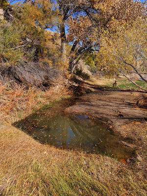
From La Jencia Assessment Fall 2009

"Apparently the tendency for the maintenance of quasi-equilibrium in stream channels is sufficiently pervasive that only slight deviations, if sustained for long enough periods of time, may account for aggradational features of considerable magnitude, but the deviation from equilibrium conditions necessary for the construction of such depositional features cannot be recognized or identified by any criteria now available. Only by measurement over time can the net direction of river change be determined..." (Leopold, ibid)

Flannery's Theory of Ecosystem Nutrient Cycling


Tim Flannery's exposition of fire- vs herbivore-dominated ecosystems:

"Large herbivores return nutrients to the soil quickly and with a bonus (nitrogen fertilizer). Fire returns nutrients to the soil only after a long period--and then at a considerable loss. As a result, fire and soils act to promote each other. Together, they can produce an ecosystem which is spiraling ever downwards as nutrients become fewer while fires become more important.

The result of this cycle is an accelerated selection for scleromorph plants, which can survive in nutrient-poor soils. A self-reinforcing cycle of soil impoverishment, soil drying and soil exposure is then initiated. Much water is lost through runoff in such situations before it can be returned to the skies through transpiration. This lowers effective rainfall. Degradation can go so far that even if fire can be stopped, the soil is so impoverished that it can no longer support the kinds of plants needed to feed large herbivores. Thus, the change can be made almost irreversible.

A canopy of broad-leaved 'dry' rainforest species, such as survives in tiny fire refuges across the north of Australia today, could, if they were more widespread, enhance rainfall by up to 60 percent and push rainfall much further south. This is because the plants and the soils they protect retard the runoff of water. Through the leaves in their dense canopy they release vast amounts of the trapped water as moisture into the atmosphere. During the wet season, the winds blow in from the coast. As a result, the moisture transpired by the plants is formed into clouds and blown southwards to fall again as rain.

Most of northern Australia is covered with eucalypt woodlands today. After rain, the water rains rapidly away, for the plants and thin soil cannot hold it. The release of moisture to the atmosphere through the narrow eucalypt leaves is insufficient to form significant clouds. As a consequence, the rainfall gradient between the coast and inland is incredibly steep in northern Australia."

The diagram at the beginning shows three types of soil: Mor, Moder, and Mull, which range from slow/intermittent decomposition (Mor-fire) to fast/continuous decomposition (Mull-earthworms).

Tamarix ramosissima survey on White Sands National Monument

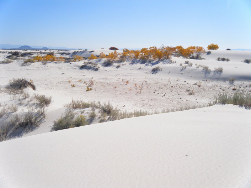
White Sands National Monument is located in the Tularosa Basin and surrounded by White Sands Missile Range, the site of the first atomic bomb test. The area is desolate and remote and still used for target practice. The dunes are composed of gypsum, a salt that accumulates in the dry lakes and playas of this closed basin.

From White Sands National Monument

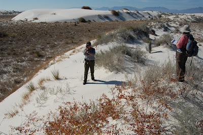
Our Mission: Vegetation mapping plus Search & Destroy Tamarix ramosissima AKA Russian Salt Cedar. Our goal was to ground-truth vegetation maps and locate populations of this invasive species for possible future air strikes.
From White Sands National Monument

Cottonwoods grow in the dunes because of the shallow water table.
From White Sands National Monument

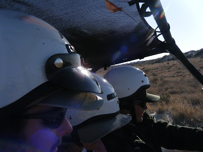
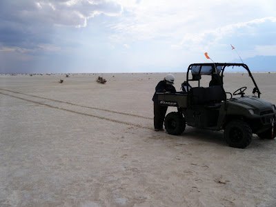
We traveled by sand buggy.

From White Sands National Monument


From White Sands National Monument
Many dunes are stabalized by Rhus Trilobata (Skunkbush Sumac), Poliomentha (Rosemary Mint Bush), Chrysothamnus (Rabbitbrush, Chamisa), and Yucca.

From White Sands National Monument
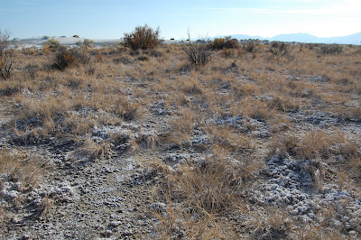
Tamarix ramosissima visible in the background. The foreground is covered by a thick salt crust.

Friday, November 06, 2009

Rapid Climate and Vegetation Change in Arizona

Recent modeling (deMenocal et al 2000 Quaternary Science Reviews) of the Sahara's transition from a Serengeti-like grassland to sand dunes indicates that the transition, while forced by overall climate change, happened suddenly, probably as a result of positive feedback from vegetation changes:

As vegetation declined, a critical point occurred around 5500 years ago and the Sahara was born, in possibly only 100-200 years. The top chart shows overall climate change, the two middle charts show models without, and with, vegetation feedback, and the bottom chart shows the paleoecologic record, where "Terrigenuous Flux" is a measure of erosion and sand dune formation.

An analogous rapid vegetation change has been observed in the American Southwest, prompting some to ask if Arizona and New Mexico could be the next Sahara...
(image composite from Santa Rita Experimental Range, University of Arizona)
As landcover transitions from grasslands to sparse shrublands, erosion can increase (Breshears et al 2003 Earth Surface Processes and Landforms). Vegetation cover can also influence rainfall (Kurc et al 2003 Water Resources Research), initiating a positive feedback.

The long-range outlook for the American Southwest is not good: “Model Projections of an Imminent Transition to a More Arid Climate in Southwestern North America” — yes, “imminent” — and reports “a broad consensus among climate models” that a permanent drought, bringing Dust Bowl-type conditions, “will become the new climatology of the American Southwest within a time frame of years to decades.” (Seager et al 2007 Science)
Four representative climate models showing Precipitation minus Evapotranspiration over the entire Southwest. The second model, GFDL, is arguably the worst scenario. However, because the Southwest is so dependent on the Summer monsoon, whose dynamics are not well understood, these models should be taken with a grain of salt. Interestingly, El Nino events in the Southern Pacific, which are marked by increased sea-surface temperatures, often increase the ammount of rainfall in the Southwest, especially during the Winter. Indeed, we have been experiencing a strong El Nino since April which has resulted in a nice wet summer, and hopefully will continue with a wet winter as well. Stong El Nino's also correlate with decreased precipitation in the Northwest, which explains why Washington had a very dry summer this year. It is interesting to note that this relationship has changed over time.


However, the vegetative response to El Nino isn't always simple, either. While summer rains definately benefit native C4 grasses, winter rains tend to benefit invasive C3 shrubs. So, even if the total ammount of precipitation doesn't change, a changed timing or frequency/intensity could continue to drive massive vegetative change, which could in turn continue to influence the climate.

USGS concludes 2006 was 1,000-year flood near Tucson


Floods are described in terms of their recurrence interval. A 10-year flood has a 1 in 10 chance of occuring each year. Many engineers and flood planners work with 100-year floods, since this is approximately the length of accurate and reliable observations in the West. However, much larger events can, and do, occur.

After studying the aftermath of the floods that wiped out Sabino Canyon in Tucson in 2006, the USGS has concluded that the event was virtually unprecedented. By dating geological deposits, they estimated that the floods that swept down most of the West-facing canyons in the Santa Catalina Mountains were probably on the order of a 1,000 year flood.

However, with climate change and associated land cover changes on the mountains, that interval may no longer hold. Pearthree, section chief of AZGS Environmental Geology, warns, “increasing fire frequency on the steep slopes of the Santa Catalina Mountains due to invasive species like bufflegrass may result in greater runoff, and possibly increased debris flow frequency, in the coming decades.”

Details, including an map.

Other recent flash floods.

Wednesday, November 04, 2009

Quivira Coalition Water Symposium


Quivira Coalition Annual Conference


Speakers I enjoyed:

Peter Warshall
A-->B Horizon (CF. History of Greece)
some grasses like B horizon (maybe Hairy Grama?)
1,000 years to restore
Vigil network data
Leopold was against "drop-in science"

Larry Schmidt
--> channel incision
lack of sediment incises below stream
-->too much water (culverts)
-->too much slope
-->wildfire causes no cover, hydrophobic soil, runoff w/out sediment
results in incised channel (sediment hungry)
positive feedback between reduced cover, dendritic incision, and loss of wateravailability

Burchard Heede Alkali Creek 40 years
showed that landscape incision could be corrected by creating a grass-lined waterway
induced meandering can also cure incision

Bill Zeedyk and Van Clothier
streams can erode bottom OR sides
*anticipate* stable form
*nudge* in that direction

e.g meander multiplier is usually between 10-20: 10 for wet sedge meadows, 18 for dry ephemeral channels
Questions:
utility of BF-FP width ratio?
how does flow become channelized (versus dispersed)
why aren't incising channels self-correcting? are they?
structures needed b/c of lack of woody debris?

Monday, October 26, 2009

Mesquite Treatment Monitoring in Lesser Prarie Chicken Habitat

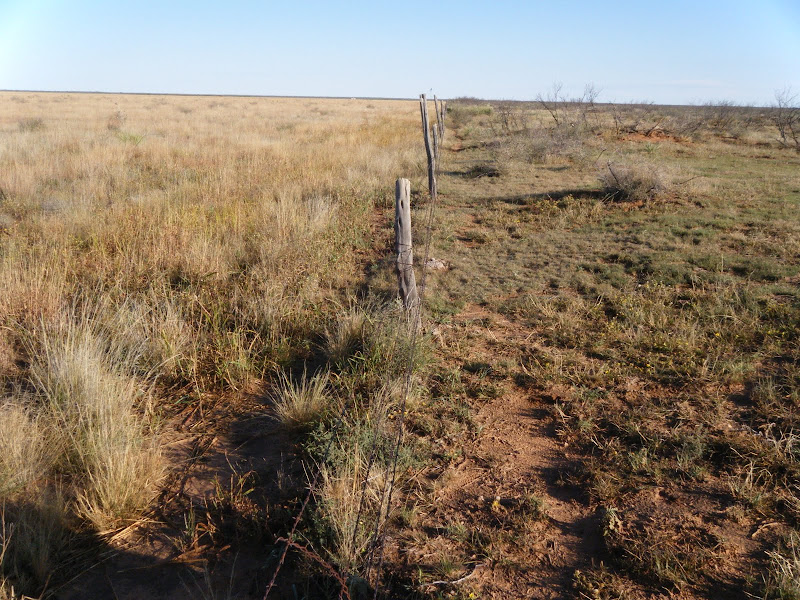
Mesquite has invaded large areas of warm semi-arid grassland, possibly due to a combination of land use and climate change. Fenceline contrasts usually indicate selective growth is due to land use; in the case below the field on the right is grazed while that on the left is a Conservation Reserve former farm field.
From Milnesand, NM
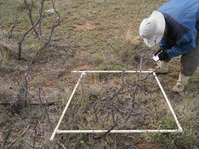
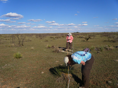
The mesquite has been sprayed with a selective herbicide in order to increase forage access for cows. Our goal was to monitor the vegetation changes associated with mesquite die-off. I also observed that mesquite and other shrubs clearly stabalize more eolian transport than do grasses.

Yvonne: "looks like pretty good kill to me. I don't know what he's complaining about. You never get 100% -- not in nature"
Rancher: "never seen it this green this time of year before"

--

lark buntings dance from mesquite to mesquite
trilling as they fly: pipsqeek joy
horsecrippler cactus
we dug and boxed for home

From Milnesand, NM
two Great Blue Herons flap-float overhead
bringing/bearing profound stillness
tarantulas still crossing road
honk/gurgle of sandhill cranes float out
of clear blue sky

From Milnesand, NM

Damn scorpions - one just crawled under fridge
pocket gopher diggings everywhere!
Panicum obtusum, virgatum
spider webs shimmer parachute? balloon?
Look! a tiny spider clutching the tiptop of a tiny Buchloe grass
it flies away, and for a moment; Pure Magic

From Milnesand, NM
12:30 2 groups of 3 and 4 cranes, circling overhead
another group of 2 joins them
we hear them long after they are lost in sky
their presence gives it dimension, then dimensionless

From Milnesand, NM

Wednesday, October 14, 2009

Tucson Field Notes

italisize scientific names

snow and hills in Arizona winter:
warming sun, purple hands in the snow & shade


Madrean oak to pinon mixed conifers
how many species of oak? and species we don't even know
sample in pockets

pinus edulis
apache pine englemanii
mexican pinyon pinus cembroides

chihuaha pine? pinus leiophylla
Ponderosa
doug fir
white pine pinus strobiformis

sycamore
alligator juniper

steep steep slopes still with soil on them
in some places, thick oak duff
overlays silt and rocks over bigger rocks and boulders and bedrock
exposed in channels and on pinacles


raccoon faced white elipses
blue colored breast
darker blue on dorsum than back
same blue makes crest color protude through white head
arrow shapped fat end over eyes
(sagital crest on forefront of head )
eye circle bigger than eyes is white
raccoon faced?


insect casings exoskeletons left behind after metamorphisis
thalictrum and gallium near trickling pools
stinging nettle near Sylvester Spring
round sedges (scirpus), rorripa
exclosure around the seeping proliferation: out of the reach of
raging floods, stable ecosystems contrast with high-disturbance
\
sylvester had stinging nettle and white pine
(pinus strobiformis)
 kent spring, at the apex or azimuth, a frozen stalagmite
and  bog with the foot-thick grape vine
springs boxed and improved "fish and game"

white breasted nuthatch

pinus leiophylla chihuaha
geranium
arbutus arizonica (ericaceae... heather the grown up form of ) like arbutus
symphoricarpous oreophilus mountain or roundleaf rotundifolius


ericaceous shrubs in the artic tundra

rhus trilobata on west facing dry hillslopes
Hoffmansegia glandular pea vine there, to


littleleaf sumac
rhus microphylla fruits small, red-hairy, {ital}

bear grass nolina microcarpa
banana yucca, Yucca baccata

parry's and shott agave (mescal and amole)


red pink ball things
green horn beetle 2mm-4mm
horn downcurved


galls we saw today
lemons in the trees: hollow dry bug galls
perforated ball of Sycamore seeds
red tiny balls
caccoon with a hole
pinecone skeleton twigs twisted together to make backbone and ribs
intricate engineering
concave sycamore with hollows
juniper stumps convex, many-trunked
grassy hills under
aligator juniper blue "bloke" oak
ecology

grape vines common near springs
swaying 30-40 feet overhead
crawling over oaks
some are a thick as 8 inch 
complex webbing

abundance and habit


-------
no cottonwood in wash
close, steep sides
bedrock confined
maiden pools? dried up


arizona rosewood  vauquelinia californica
southwestern coralbean erythrina flabelliformis growing around summit, blue "bloak" oak,
a
black phoebe
ventana canyon over stream

dodonaea viscosa called uopbush
hopbush covered burn sites and common at a certain elevation

-------------
romero pools
coursetia microphylla along rough rock trail
towering saguaro
past them to the first shady clefts
oak and fern,
then onward to flowing water over bedrock

dodea cover the site of a 2003 fire now with 10 foot luxuriant growth, hop bushes swaying in the golden light


Sunday, October 11, 2009

The Magical North Central Texas that Used To Be


North Central Texas is composed of three major ecosystems, the Cross Timbers, Black Prairie, and Fort Worth Prarie. Less than 150 years ago, sparkling streams were abundant with trout, perch, and catfish...and alligators! Indeed, Kendall (1845) found alligators along the San Gabriel in the southern Blackland Prairie as "too plentiful for any useful purposes." Black bear were also common, along with mountain lion. Brooke (1848) reports gray wolves as far east as McLennan County, ocelot in bottoms of Brazos River near Waco in McLennan County. The last jaguar record was a large male killed in Mills County (Lampasas Cut Plain) in 1903.

Other vanished creaturs out of this Noah's Ark world include river otter, ringtail (a cat-like creature), badger, javalina (collared peccary), bison, pronghorn antelope, turkeys, and prarie chickens. Many of these animals still persist in zoos or mountains out west, but some cannot be found anywhere on the planet. For example, both the ivorybilled woodpecker and the carolina parakeet, once found near modern day Dallas/Ft. Worth, are extinct.

Estimates of the destruction of the Blackland Prairie ecosystem range from 98% (Hatch et al 1990) to 99% (Riskind and Collins 1975) to more than 99.9% (Burleson 1993). Some of the last remnants can still be seen at the Nature Conservancy's Clymer Meadow Preserve. Slightly more Fort Worth Prarie and Cross Timbers survive. Dyksterhuis (1946) studied relics of the Fort Worth Prairie, and, surprisingly, Cross Timbers are still one of the largest relatively unaltered forest vegetation types in the eastern United States (Stahle &Hehr 1984), but there are more in Oklahoma, for example, Pontotoc Ridge Preserve. Examples of old-growth Cross Timbers forests in North Texas are found in Comanche County (Leon River), Tarrant County (Fort Worth Nature Center), and Throckmorton County (Nichols Ranch).

Prairie remnants are threatened by eastern red cedar (Juniperus virginiana) and cedar elm (Ulmus crassifolia) because of a lack of natural fire. Results include reduction in broad-leaved plants and increased abundance of grasses. (Diamond & Meins 1993). Over much of the slope-lands, as muich as three feet of soil have been eroded, exposing barren rock where once was prairie soil (Hayward &Yelderman 1991). So, although remnants remain, they are often degraded by various human activities such as heavy grazing or selective cutting and their authenticity is rarely noticed or protected.....I wonder how many people realize what used to be?

Much of this text, and the image, are from Shinner's and Mahler's Illustrated Flora of North Central Texas, published by Botanical Research Institute of Texas.

More great info about Texas Native Plants, from the Plant Resources Center at UT - Austin.

Saturday, September 26, 2009

Calibrating Bank Full Measurements Using Regional Curves and USGS Stream Guage Data

Bankfull is important to fluvial hydrogeomorphology (HGM) because it often determines the shape of the channel by moving and depositing sediment. Bankfull (BF) is defined as the high water level that recurs every 1 - 2 years, but measuring it in the field involves using multiple indicators in a 'preponderance of evidence' detective-style approach.

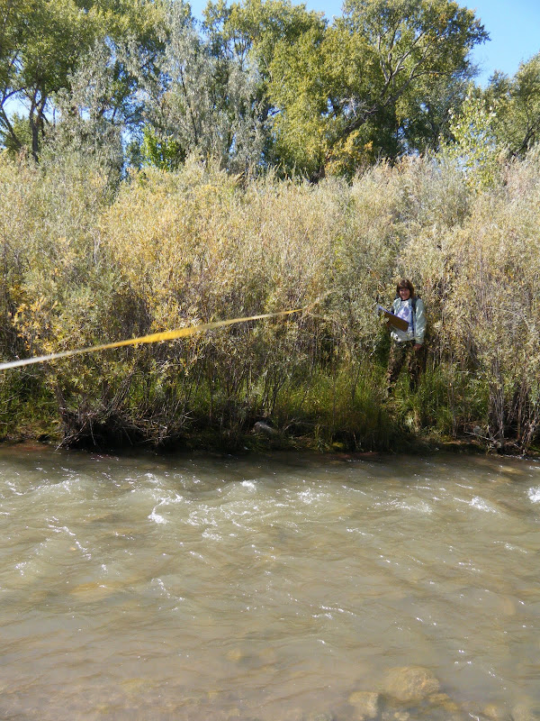
Most plants that cannot tolerate saturated soil conditions for days at a time, like Alders, will not grow below BF, while willows and cottonwood can. Also, the top of point or side bars can indicate the height of BF, but on the Rio Embudo, near Dixon NM, BF indicators were contradictory and hard to find. Is BF just a few centimeters above the base-flow water, or are all the willow below BF?
From Rio Embudo at Dixon, NM Hydrology Analysis
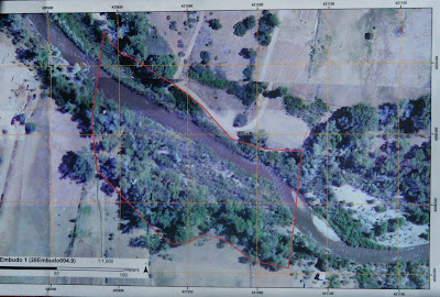
A number of bars and scour features at different heights further compounded the mystery. It was time to seek out other clues. One source of potential indicators was our aerial imagery, which was taken during Spring runoff, 2008:
From Rio Embudo at Dixon, NM Hydrology Analysis
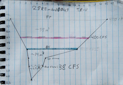
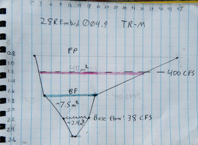
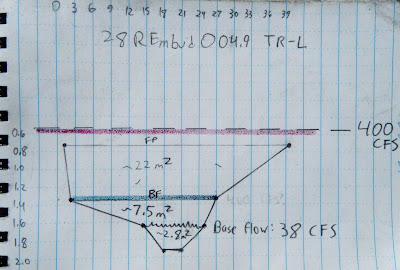
The point bars at bottom right are bisected by a side channel that is several feet above the base level today. That means BF must be at least that high, and would probably inundate most of the willows. Corroborating this, the landowner reports that the willows are indeed flooded almost every year. But exactly how high is BF? To gather more data, we surveyed three channel cross sections, or transects (TR), noting the heights of the major terraces.

TR-Upper
From Rio Embudo at Dixon, NM Hydrology Analysis


TR-Middle
From Rio Embudo at Dixon, NM Hydrology Analysis

Tr-Lower
From Rio Embudo at Dixon, NM Hydrology Analysis

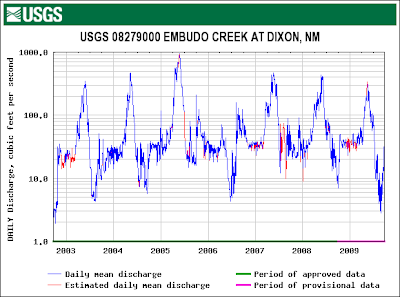
On each of these cross sections we marked where the current base flow water level is, where we think BF is, and where we think Flood Prone (FP) might be. To check these guesses, we correlated those heights with flow data from a USGS gauge just downstream:
From Rio Embudo at Dixon, NM Hydrology Analysis
From this graph we could see that the high water level with recurrence every 1 -2 years is about 400 cubic feet per second (CFS). We could also see that the current flow was about 38 CFS. If the Rio Embudo is flowing with 38 CFS today, how high would a BF flow of 400 CFS be?

between the flow today and BF flow. To figure that out we might need to correct for any changes in the velocity (feet/second). Manning's Equation:

shows that velocity V is proportional to a constant, u, inversely proportional to a coefficient of friction, n, varies to the 2/3 power of channel cross-sectional area, R, and to the 1/2 power of slope, S. Since neither slope nor the constant would change, we can discount them and focus on n and R; n will likely increase because the willows will act like a series of giant combs, increasing friction, and R will also obviously have to increase. For example, doubling the height of the water would multiply that term by 1.6. Unfortunately, coefficients of friction need to be experimentally determined, so we can only guess at n. To make things easier, I decided friction would also increase by a factor of 1.6, to exactly cancel out R. In other words, I don't think the velocity would change by much.

So it is a simple matter of geometry to calculate the cross-sectional area that would correspond to 400 CFS on our cross sections (red lines on the cross-sections, above). Without exception, this height is higher than our field-determined BF (green lines on the cross-sections, above) and, at least for TR-L, even higher than our FP height.

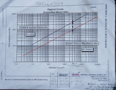
But is this right? Are we getting closer to the truth? To check, we can calibrate our answers for the Rio Embudo against data published by Natural Channel Design on a large number of other Southwestern rivers:
From Rio Embudo at Dixon, NM Hydrology Analysis
I plotted both our field-determined BF cross-sectional area (green points) and the USGS-determined BF cross-sectional area (red points) on the regional curve above. The green points seem to fall on the line for New Mexico, while the red points fall on the Arizona line, corroborating our field measurements and casting doubt on the USGS. However, the watershed above Dixon is very impermeable and could behave more like AZ than NM. I think the true value is probably somewhere in-between the field and USGS values.

This line is probably as close as any to Bankfull:
From Rio Embudo at Dixon, NM Hydrology Analysis