
As one of the Southernmost perennial streams in the Sangre de Christo Range, Big Tesuque Creek, just minutes outside Santa Fe, is a hotspot of biodiversity and a popular hike/bike/equestrian trail. We visited the area a week ago, on the 12th, but came back again this week because we ran out of daylight last time. On a 3.5 mile hike along the Rosgen Class "B" (controlled by colluvial processes) we crossed the creek almost a dozen times and identified more than 40 species. There are several we could not identify, and photos of these are included first. Click on the images to view the full size.
 |
| From Big Tesuque Creek Hike -- Spring Wildflowers! |
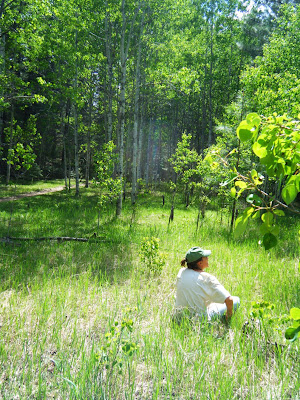
Enjoying the meadow at the upper trail junction. Since there was not much more than a couple violets, Thermopsis, Dandylions, and Mertensia (Chiming Bells), we decided to head down.
 |
| From Big Tesuque Creek Hike -- Spring Wildflowers! |
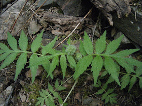
Hydrophyllum.
 |
| From Big Tesuque Creek Hike -- Spring Wildflowers! |
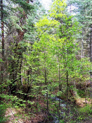
Habitat, showing mid canopy of Alder under Douglas Fir overstory.
 |
| From Big Tesuque Creek Hike -- Spring Wildflowers! |
 |
| From Big Tesuque Creek Hike -- Spring Wildflowers! |
Species List
Ponderosa upland -- alder and box elder are prominent, Douglas Fir more so further up the canyon. We counted more than 40 species in flower (designated by an *)
*Tragopogon pratensis - Yellow Salsify
*Clematis columbiana - Rocky Mountain Clematis
*Lathyrus eucosmus - Wild Sweetpea
*Lupinus caudatus ssp. argophyllus - Spurred Lupine
*Many daisies
*Ash??
*Cherry
*Mertensia lanceolata - Lanceleaf Bluebells (some with white, some with blue flowers)
Heracleum maximum - Cow Parsnip
*Viola canadensis - Canada Violet
*Viola nephrophylla - Kidney-leaved Violet
*Cardamine cordifolia - Bittercress
*Valeriana arizonica
*Verbena spp?
*Androsace septentrionalis - Northern Rock Jasmine
*Aquilegia elegantula - Elegant Columbine
*Sambucus recemosa - Red Elderberry
*Actaea rubra - Baneberry
Cercocarpous montanus - Mountain Mahogany
Potentilla anserina
*Geum macrophyllum - Cut-leaves Avens
Geranium spp.
*Erysimum capitatum - Western Wallflower
*Fragaria vesca ssp. americana - Wild Strawberry
*Moehringia/Stellaria spp?
*Maianthemum racemosum - False Solomon's Seal
*Quercus spp.
*Besseya plantaginea - Kitttentails
Vaccinium myrtillus(?)
*Berberis fenleri - Fendler Barberry or Mahonia
*Acer glabrum - Rocky Mountain Maple
Plantago major - Common Plantain
*Taraxacum officinale - Dandylion
*Trollius laxus (?) Globe flower, Ranunculaceae
*Ranunculus ssp. - Buttercup
*Utah Serviceberry
*Alder
Thalictrum
*Several kinds of carrot
Gallium
*Oregon Grape
*Astragalus
*Penstemon
*Indian Paintbrush
Delphinium spp.
*Thermopsis
Wax currant
Gooseberry
*Antennaria spp.
Equisetum spp.
Box elder
I would write more but I am completely exhausted from hiking and botanizing all day.


