Sitting on the fence has become a metaphor for ambivalence, but actual fence lines are some of the clearest lessons in land management. Fencelines can be the best place to study ecology, because most fences divide two different land management histories. The easiest places to learn from fence line contrasts is where the land management history is known. For example, along highway right-of-ways (ROWs), the strip of land between the road and the fence is almost never grazed, whereas the private or public alotment on the other side of the fence has almost certainly been grazed and/or farmed.
However, just because the ROW hasn't been grazed doesn't mean that it has escaped disturbance. While comparing two disturbed areas can yield some insights, the multiple factors at work will make cause and effect deductions extremely difficult. To find a good comparison, look for areas that are relatively far from the road; immediately adjacent to the road is a zone of disturbance, which can include vehicle traffic, trash, mowing, and runoff from the road (i.e. increased moisture).
The best comparison areas occur where the ROW is relatively higher than road (so there is no possibility of runoff and little chance of other human disturbance). However, areas with cutbanks below them are not good for comparisons, because of excess erosion, different microclimates around bare rock or exposed subsoil, and lowered water table. A zone of depression in soil moisture can also occur around ditches, trenches, gullies, roadcuts, etc.
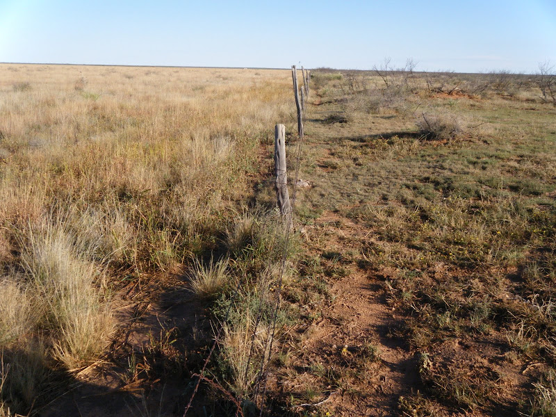
The actual fence-line itself may have different species due to fence-line drip of dew and the ability of fences to catch seeds, especially tumbleweeds. (photo).
On the ground immediately beyond the fence there may be an area of extra disturbance due to cattle trails, etc, and any areas near stock tanks or gates are also likely more heavily used (and hence a more extreme contrast). In cases with less grazing on the private land, such as on steep hill slopes, vegetation and soils may look quite similar across fence-lines. Of course, there will always be variable disturbance on both sides of the fence, but that is part of the challenge and opportunity of observing fence-line contrasts.
The best comparisons are between areas relatively far from disturbance, close to but not immediately adjacent to the fence-line. With a good undisturbed ROW as a control, the vegetation on the other side of the fence can be compared to the potential climax community of the site.
Case Example:
I was recently watching fence-lines along NM highway 285 from Vaughn to Clines Corners, and noticed that typical overgrazed areas are Grama Grass (Bouteloua gracilis) monocultures or low-stature annuals with large amounts of bare dirt. The ungrazed roadsides still have bare ground, but the vegetation has a starkly different structure and composition: multiple grass species occur with different growth forms. But even more noticeable than the grass growth is the shrub encroachment in an area that is pure grassland. Without fire or grazing, woody growth, especially saltbush (Atriplex canescens) and Chimisa (Ericameria nauseosa) increases markedly.
While some trees and shrubs (e.g. E. nauseosa) are resistant to grazing when mature, their seedlings are highly palatable. Cows can completely eliminate woody overstories from riparian areas in a single generation simply be eliminating recruitment (through both grazing and trampling) of Cottonwood and Willow seedlings. Grazing pressure on seedlings is important, but easily overlooked: as long as there are trees, we describe an ecosystem as a forest. And it may seem strange to say that cows are eating a forest. But without seedling regeneration, no ecosystem is sustainable.
That grazing impacts woody growth as much or more than herbaceous growth is well-known along rivers and wetlands, but I think has been less remarked on in uplands. From this brief study of fence-line contrasts, it appears that even more of our grasslands would support shrublands were it not for either grazing or fire limiting woody plant establishment.
Showing posts with label fenceline. Show all posts
Showing posts with label fenceline. Show all posts
Monday, April 06, 2015

Monday, October 26, 2009
Mesquite Treatment Monitoring in Lesser Prarie Chicken Habitat
Mesquite has invaded large areas of warm semi-arid grassland, possibly due to a combination of land use and climate change. Fenceline contrasts usually indicate selective growth is due to land use; in the case below the field on the right is grazed while that on the left is a Conservation Reserve former farm field.
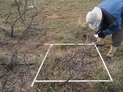
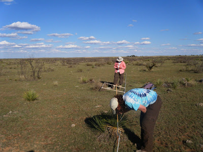
The mesquite has been sprayed with a selective herbicide in order to increase forage access for cows. Our goal was to monitor the vegetation changes associated with mesquite die-off. I also observed that mesquite and other shrubs clearly stabalize more eolian transport than do grasses.
Yvonne: "looks like pretty good kill to me. I don't know what he's complaining about. You never get 100% -- not in nature"
Rancher: "never seen it this green this time of year before"
--
lark buntings dance from mesquite to mesquite
trilling as they fly: pipsqeek joy
horsecrippler cactus
we dug and boxed for home
two Great Blue Herons flap-float overhead
bringing/bearing profound stillness
tarantulas still crossing road
honk/gurgle of sandhill cranes float out
of clear blue sky
Damn scorpions - one just crawled under fridge
pocket gopher diggings everywhere!
Panicum obtusum, virgatum
spider webs shimmer parachute? balloon?
Look! a tiny spider clutching the tiptop of a tiny Buchloe grass
it flies away, and for a moment; Pure Magic
12:30 2 groups of 3 and 4 cranes, circling overhead
another group of 2 joins them
we hear them long after they are lost in sky
their presence gives it dimension, then dimensionless
 |
| From Milnesand, NM |
Yvonne: "looks like pretty good kill to me. I don't know what he's complaining about. You never get 100% -- not in nature"
Rancher: "never seen it this green this time of year before"
--
lark buntings dance from mesquite to mesquite
trilling as they fly: pipsqeek joy
horsecrippler cactus
we dug and boxed for home
 |
| From Milnesand, NM |
bringing/bearing profound stillness
tarantulas still crossing road
honk/gurgle of sandhill cranes float out
of clear blue sky
 |
| From Milnesand, NM |
Damn scorpions - one just crawled under fridge
pocket gopher diggings everywhere!
Panicum obtusum, virgatum
spider webs shimmer parachute? balloon?
Look! a tiny spider clutching the tiptop of a tiny Buchloe grass
it flies away, and for a moment; Pure Magic
 |
| From Milnesand, NM |
another group of 2 joins them
we hear them long after they are lost in sky
their presence gives it dimension, then dimensionless
 |
| From Milnesand, NM |
Thursday, May 08, 2008
Rio Puerco: the Poster Child of Eroded Watersheds
 [NOTICE - This Road Not Maintained by New Mexico State Highway Department]
* Frederick Jacson Turner, father of modern American history, wrote persuasively that the frontier (where less than 3 people lived per square mile) defined American life, but that it closed in the 1890's as the country filled up with emigrants and settlers. But the land is emptying out again, as chronicled in Richard Manning's Grassland. The old world ecology and thinking brought by the Anglo settlers is failing in the drylands of the American West and the people are leaving, the roads abandoned. Despite massive government subsidies, the remaining ranchers and farmers have less and less to stand on every year. Populations in most rural counties peaked in the early 1900's and have declined ever since. The exodus that started with the dust bowl has continued unabated, as has the soil erosion and ecological damage.
 [Could this be restored to its original ecology of cottonwood/willow bosque and gallery forest?]
Now, The Good News: "This is a search for the unknown...Now the sun is here, and he simply watches the land year by year to see what happens, waiting for the next clues as to what the nature of this place might be...It's like a ratchet in that we take the first turn, then back off and let nature take a turn, as we listen and watch as closely as possible, knowing that we are not so much rebuilding nature in these places as nature is rebuilding us. With each turn of this ratchet, nature reveals a bit more of itself to our science."
 [SUN]
[SUN]"In some real ways, the effort to re-find the landscape, which is the same as the effort to re-attach our lives to the land, is a religious quest, and it makes sense to consider it that way.
 [Erosion (so bad it took 2 photos to fit): The bridge on the left used to span the river chanel. This is why the road is closed. Nature fights back. ]
"...it is difficult to imagine what we have learned. Annual topsoil loss to erosion here in some years totals one hundred tons per acre, or an inch of topsoil removed every 1.6 years...the topsoil the grass had built was thought to be so deep as to be inexhaustible..." p.165 from Grassland, Richard Manning.
 [Dead willow, killed incidentally with herbicide "friendly fire"]
Mutilated and mutated willows, the taste of heavy metals on the tongue: this place has been sprayed. "Many in federal agencies ignore the connection between livestock grazing and weed invasions. Since they deny the role of livestock grazing, they seldom reduce the number of livestock allowed to graze public lands, even in areas where weeds are a major problem. Agency personnel prefer using herbicides and biocontrol agents to eradicate the weeds rather than trying to prevent the invasion of weeds in the first place." From "Comrades in Harm: Livestock and Exotic Weeds in the Intermountain West", Joy Belsky and Jonathan L Gelbard. in Welfare Ranching, Earth Island Press
 [Rio Puerco Watershed: this area could be a State]
John Wesley Powell recommended that states and counties' boundaries in the American West be demarcated based on watersheds, since water is the natural form that power takes on the land...today, as witnesses of the modern West's "Water Wars" can attest, more and more political boundaries are being created or determined by water rights.
The Rio Puerco is oft mentioned as an example par excelance of some of the worst erosion in the United States. Once the "Breadbasket of New Mexico", the Rio Puerco watershed is now given as a common example of the degradation that can befall such formerly productive areas through mismanagement and ecological ignorance. Enhanced rates of erosion on the "dirty river" are the cause and effect of downcutting in the soft alluvium that formerly supported such bountiful harvests. Unstoppable headcuts and devegetated banks, combined with a climate shift that creates more "flashy" events (which, of course, are also caused by devegated uplands that lack competence and capacity to absorb rainfall, leading to sheetflow and immediate runoff that feed back to cause even more erosion...
 [Landslide]
The Rio Puerco Management Committee lists several causes of erosion, such as (over) grazing and the placement of the new highway. As you can see from this photo essay, the war between the road and the river is not over yet. However, much of the battle has already been lost, and the country abandoned without roads. The downstream is reachable only by unimproved dirt roads and crosses some of the remotest parts of the state.
 [Fenceline showing effects of grazing, on the right, where thickets of sagebrush dominate]
Subscribe to:
Posts (Atom)