Thursday, December 24, 2009
Americans throw away more food than most people consume
According to a paper by Kevin Hall et al in PLoS, Americans waste about 1,400 Calories a day, about as much as is needed to feed an average adult in much of the world. They arrived at this figure by calculating the total number of food calories produced on farmland in America (plus imports, minus exports) and compared this to the total calories consumed by Americans. Although we Americans are doing our best to consume large amounts of food, we still end up throwing away or otherwise wasting enough food every day to feed another person.

Saturday, December 12, 2009
Dying Forests
“For as long as people have been looking at such things, we have never had the series of attacks on forest health all occurring at the same time that we are currently experiencing,” said Alex Woods, a forest pathologist in British Columbia. San Diego News Story: Drought, Beetles Killing Forests 10/25/08

Even this wide-reaching chart apparently doesn't have room to show SAD (Sudden Aspen Death) nor the Southwestern Pinyon Pine Die-Off. The title of the paper in PNAS (2005) by Dr. Breshears et al sums it up: "Regional vegetation die-off in response to global-change-type drought."

In Colorado, spruce beetles have killed entire forests around North Park. Throughout the central Rockies, approximately 2.5 million acres have been or are being destroyed.
 White Pine is also dying throughout the West, and although those maps are still being drawn, the outlook isn't good: "We're watching the collapse of an ecosystem in less than a decade. " A view of part of the forest mapped above:
Some possible causes. One proposed solution.

Even this wide-reaching chart apparently doesn't have room to show SAD (Sudden Aspen Death) nor the Southwestern Pinyon Pine Die-Off. The title of the paper in PNAS (2005) by Dr. Breshears et al sums it up: "Regional vegetation die-off in response to global-change-type drought."

In Colorado, spruce beetles have killed entire forests around North Park. Throughout the central Rockies, approximately 2.5 million acres have been or are being destroyed.
White Pine is also dying throughout the West, and although those maps are still being drawn, the outlook isn't good: "We're watching the collapse of an ecosystem in less than a decade. " A view of part of the forest mapped above: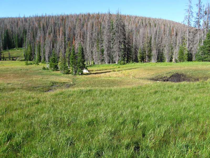 |
| From New Mexico Work |
Wednesday, December 09, 2009
Anthropogenic Climate Change
 click map for animation
Interestingly, I've also concluded that climate change skeptics are actually a boon to climate scientists. Their consistent questioning helps bring attention, interest, and even intrigue to discourse that might otherwise tend toward dry fact. And their analyses provide ready-made hypotheses to test for young graduate students. However, after considering their claims and scientist's responses, I can not doubt that the best available science indicates humans are modifying a continually changing climate at unprecedented rates. The climate is warming, and more and more of that change is attributable to humans.
However persuasive the evidence may be, it can also be overwhelmingly complex; the important point to remember is that we are having a significant effect on the environment. But you don't need 10,000+ dedicated and careful scientists to tell you that. Climate change skeptics start from a disbelief that humans could modify something as large as the entire Earth ecosystem. But look around you. Odds are, your entire environment is human-made. And it doesn't stop there. From airplane flights or Google maps we see human civilization spilling out over vast swathes of the landscape. Even in areas that are not paved over, the trained ecologist sees omnipresent invasive species, erosion, and pollution. In many parts of the world, natural areas have been completely transformed by human activity.

My favorite climate change objection raises the possibility of bias in temperature readings taken from areas that have recently urbanized. This "urban heat island" effect is a known source of bias and is corrected for in long-term temperature trends. However, it is becoming more difficult to find locations unaffected by urban heat islands effects as urban areas increase in size and coalesce into megacities. This, at least, is incontrovertible fact: we are seeing a complete transformation of the surface of the earth. Indeed, 2008 was the first year that more people lived in cities than in rural areas.

The good news is that although our impact on the environment is significant, and growing, it is largely based on cumulative effect: in any given year, we are not really that far from a sustainable society. Ending coal power and then using clean energy to power our transportation networks could do it. However, the first step is to stop building new coal power plants. If not for the critical build-up of heavy metals pollutants in the food chain, or the respiratory health of people who live near coal plants, or the massive ecological devastation of mountaintop removal and open-pit mines, than for the entire health and fate of the planet.
 click image for fire animation
I have read the papers and considered the arguments and believe that we must act. Business-as-usual imposes an unacceptable risk of catastrophic consequences. There should always be time for doubt and discussion, but not while we and China continue to build coal power plants.
In-depth scientific information on climate change.
Sunday, December 06, 2009
Ecotourism in Mexico
Chamela-Cuixmala Biosphere Reserve, Jalisco,
Thick-billed parrot preserves on Ejido...(mentioned in Wildlands Connections)
Thick-billed parrot preserves on Ejido...(mentioned in Wildlands Connections)
Monday, November 16, 2009
La Jencia Restoration Project Evaluation after 10,000 CFS Summer Flood
"No characteristics of the channel provide indication of why some reaches scoured when the rest of the reach filled ... When there are a large number of interrelated factors which must adjust among themselves in response to occurrences in the environment, such as storms or flows, it should be expected that there will generally be an indeterminacy in the manner of this mutual adjustment.... Where a particular factor dominates, such as a bedrock floor of a channel, the effects of this factor may be readily evident. However, where the alternatives become more nearly equivalent it becomes more difficult to specify the precise form in any give case...This indeterminacy in a given case results from the fact that the physical conditions, being insufficient to specify uniquely the result of the interaction of the dependent variables, are controlled by a series of processes through which any slight adjustment to a change imposed from the environment feeds back into the system." (Leopold, Wolman, Fluvial Geomorphology. describing the equivocal results on their study of the dry wash (ephemeral channel) near Santa Fe, NM Arroyo de los Frijoles:)
 |
| From La Jencia Assessment Fall 2009 |
Context: La Jencia Ranch is located near the continental divide, west of the Rio Grande, north of the Magdalena mtns at about 5500 feet in a broad almost-closed basin composed of Pleisticene-sediment. Springs feed an intermittent reach in what is otherwise an ephemeral system. The watershed above this point is approximately 350 square miles, and large bursts of storm water have contributed to massive erosion in this area. By anecdotal reports, this entire canyon system (with 100+ foot walls) has cut in the last 120 years since Anglos homesteaded in the 1880s. This report is corroborated by the evidence of recently rejuvenated side canyons and active headcuts.
A continuing riparian restoration project has been focused on planting trees throughout the developing floodplain and meander cutoffs near ranch HQ. The continued lateral and vertical (down-cutting) erosion in the canyon is a management concern.
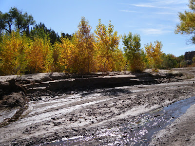
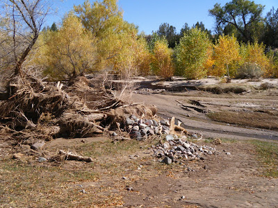
In the storm of 2006 a number of major hydrogeomorphic changes took place, notably the cutoff of several large meanders. This had the effect of significantly shortening and steepening the main channel. In a ~10 foot flood this September, another large meander was cutoff, in addition to significant erosion (and deposition) in other parts of this very dynamic system.
 |
| From La Jencia Assessment Fall 2009 |
Observations:
scoured out or deposited feet of sediment on benches cuts some places, stable others
looks like it wants to meander morehas active floodplain
flood was 6-10 feet high
widened in some places
in other places sedges and willows in middle survived
large meander cutoff downstream of house
General Conclusions: did not downcut (degrade) during this flood, contra the 2006 flood. While an over-meander did cutoff as could be expected, it did not create a headcut, as was feared.
stream has access to floodplain. some deposition and scour over this surface is natural. La Jencia is a high-disturbance system.
NOT Down-cutting, and possibly AS GOOD AS IT GETS
 |
| From La Jencia Assessment Fall 2009 |
Caveats: It is important not to be drawn into individual cut banks, but rather to evaluate the system on a whole.; "the failure of some in stream willow plantings (ISWP) does not invalidate the concept". In fact, some of the outside-meander plantings did hold. Other reaches of the channel that don't bend as much and had thick sedge growth were almost unchanged. Eventually, the entire channel could look like these reference reaches. However, whether planting can drastically change what would already happen otherwise, is unknown. Perhaps more a function of how many years between scouring floods.
Problems: inability to think in derivatives (rates)
"average" wide distributions of high frequency-low magnitude events with low frequency-high magnitude events
talk about average or equilibrium in the midst of constant flux (writhing serpent metaphor for channel evolution)
think about very complex systems (see climate change). things are changing, but is there a trend (what scale to think (average) at?) and are we affecting it?
compute running averages at different scales
Case Examples:
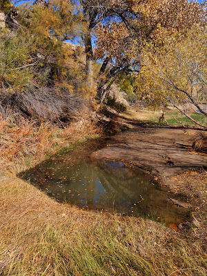
There's a difference between downcutting (lowering of base elevation) and degrading, which could include lateral erosion. Steepening is another thing altogether. So, for example, at the meander cut-off, the grade steepened and the channel length shortened, but a headcut did not start, and areas immediately upstream and downstream are still at the same elevation, so downcutting did not occur. Whether this area ends up aggrading at the bottom of the steepened section or degrading at the top of the section depends on the nature of future hydrographs and sediment supplies.
Uplands:
The uplands are key to understanding how "natural" the channel evolution and morphology are. Grazing stress has been removed on-site, but could still be contributing to watershed degradation. Measurements of runoff on grazed and ungrazed areas of the watershed could yield calculations about the magnitude and frequency distribution of floods. La Jencia, like other ephemeral streams, may not be wet enough to support enough veg to maintain stability in the face of giant floods. Or maybe floods are changing in magnitude.
If the channel is slightly unstable, as indicated by the variance of Van's channel cross sections, this continued instability could be attributed to the nature of the system (basically, ephemeral) and/or the condition of the contributing watershed (degraded, causes increased ephemerality and flashiness).
Van emphasized the sediment supply could be contributing to instability, and that this sediment was locally generated by the magnitude of these events. Was this a 20-year flood?
 |
| From La Jencia Assessment Fall 2009 |
"Apparently the tendency for the maintenance of quasi-equilibrium in stream channels is sufficiently pervasive that only slight deviations, if sustained for long enough periods of time, may account for aggradational features of considerable magnitude, but the deviation from equilibrium conditions necessary for the construction of such depositional features cannot be recognized or identified by any criteria now available. Only by measurement over time can the net direction of river change be determined..." (Leopold, ibid)
Flannery's Theory of Ecosystem Nutrient Cycling

Tim Flannery's exposition of fire- vs herbivore-dominated ecosystems:
"Large herbivores return nutrients to the soil quickly and with a bonus (nitrogen fertilizer). Fire returns nutrients to the soil only after a long period--and then at a considerable loss. As a result, fire and soils act to promote each other. Together, they can produce an ecosystem which is spiraling ever downwards as nutrients become fewer while fires become more important.
The result of this cycle is an accelerated selection for scleromorph plants, which can survive in nutrient-poor soils. A self-reinforcing cycle of soil impoverishment, soil drying and soil exposure is then initiated. Much water is lost through runoff in such situations before it can be returned to the skies through transpiration. This lowers effective rainfall. Degradation can go so far that even if fire can be stopped, the soil is so impoverished that it can no longer support the kinds of plants needed to feed large herbivores. Thus, the change can be made almost irreversible.
A canopy of broad-leaved 'dry' rainforest species, such as survives in tiny fire refuges across the north of Australia today, could, if they were more widespread, enhance rainfall by up to 60 percent and push rainfall much further south. This is because the plants and the soils they protect retard the runoff of water. Through the leaves in their dense canopy they release vast amounts of the trapped water as moisture into the atmosphere. During the wet season, the winds blow in from the coast. As a result, the moisture transpired by the plants is formed into clouds and blown southwards to fall again as rain.
Most of northern Australia is covered with eucalypt woodlands today. After rain, the water rains rapidly away, for the plants and thin soil cannot hold it. The release of moisture to the atmosphere through the narrow eucalypt leaves is insufficient to form significant clouds. As a consequence, the rainfall gradient between the coast and inland is incredibly steep in northern Australia."
The diagram at the beginning shows three types of soil: Mor, Moder, and Mull, which range from slow/intermittent decomposition (Mor-fire) to fast/continuous decomposition (Mull-earthworms).
Tamarix ramosissima survey on White Sands National Monument
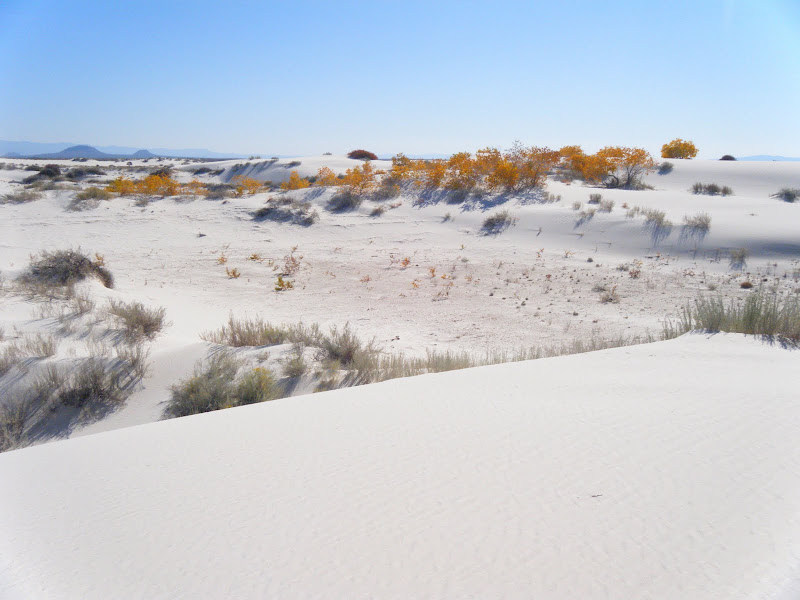
White Sands National Monument is located in the Tularosa Basin and surrounded by White Sands Missile Range, the site of the first atomic bomb test. The area is desolate and remote and still used for target practice. The dunes are composed of gypsum, a salt that accumulates in the dry lakes and playas of this closed basin.
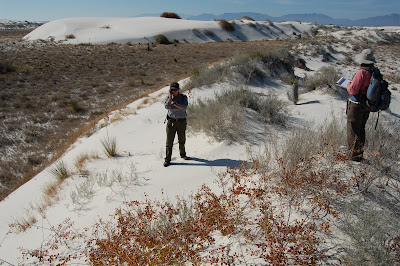
Our Mission: Vegetation mapping plus Search & Destroy Tamarix ramosissima AKA Russian Salt Cedar. Our goal was to ground-truth vegetation maps and locate populations of this invasive species for possible future air strikes.
Cottonwoods grow in the dunes because of the shallow water table.
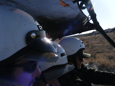
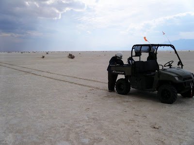
We traveled by sand buggy.
Many dunes are stabalized by Rhus Trilobata (Skunkbush Sumac), Poliomentha (Rosemary Mint Bush), Chrysothamnus (Rabbitbrush, Chamisa), and Yucca.
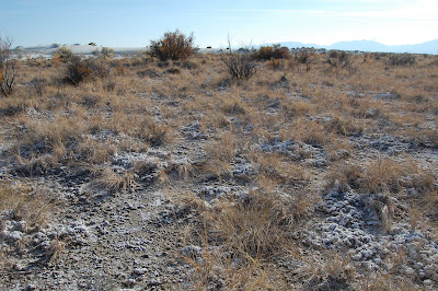
Tamarix ramosissima visible in the background. The foreground is covered by a thick salt crust.
 |
| From White Sands National Monument |
Our Mission: Vegetation mapping plus Search & Destroy Tamarix ramosissima AKA Russian Salt Cedar. Our goal was to ground-truth vegetation maps and locate populations of this invasive species for possible future air strikes.
 |
| From White Sands National Monument |
Cottonwoods grow in the dunes because of the shallow water table.
 |
| From White Sands National Monument |
We traveled by sand buggy.
 |
| From White Sands National Monument |
 |
| From White Sands National Monument |
 |
| From White Sands National Monument |
Friday, November 06, 2009
Rapid Climate and Vegetation Change in Arizona
Recent modeling (deMenocal et al 2000 Quaternary Science Reviews) of the Sahara's transition from a Serengeti-like grassland to sand dunes indicates that the transition, while forced by overall climate change, happened suddenly, probably as a result of positive feedback from vegetation changes:

As vegetation declined, a critical point occurred around 5500 years ago and the Sahara was born, in possibly only 100-200 years. The top chart shows overall climate change, the two middle charts show models without, and with, vegetation feedback, and the bottom chart shows the paleoecologic record, where "Terrigenuous Flux" is a measure of erosion and sand dune formation.
An analogous rapid vegetation change has been observed in the American Southwest, prompting some to ask if Arizona and New Mexico could be the next Sahara...
 (image composite from Santa Rita Experimental Range, University of Arizona)
As landcover transitions from grasslands to sparse shrublands, erosion can increase (Breshears et al 2003 Earth Surface Processes and Landforms). Vegetation cover can also influence rainfall (Kurc et al 2003 Water Resources Research), initiating a positive feedback.
The long-range outlook for the American Southwest is not good: “Model Projections of an Imminent Transition to a More Arid Climate in Southwestern North America” — yes, “imminent” — and reports “a broad consensus among climate models” that a permanent drought, bringing Dust Bowl-type conditions, “will become the new climatology of the American Southwest within a time frame of years to decades.” (Seager et al 2007 Science)
 Four representative climate models showing Precipitation minus Evapotranspiration over the entire Southwest. The second model, GFDL, is arguably the worst scenario. However, because the Southwest is so dependent on the Summer monsoon, whose dynamics are not well understood, these models should be taken with a grain of salt. Interestingly, El Nino events in the Southern Pacific, which are marked by increased sea-surface temperatures, often increase the ammount of rainfall in the Southwest, especially during the Winter. Indeed, we have been experiencing a strong El Nino since April which has resulted in a nice wet summer, and hopefully will continue with a wet winter as well. Stong El Nino's also correlate with decreased precipitation in the Northwest, which explains why Washington had a very dry summer this year. It is interesting to note that this relationship has changed over time.

However, the vegetative response to El Nino isn't always simple, either. While summer rains definately benefit native C4 grasses, winter rains tend to benefit invasive C3 shrubs. So, even if the total ammount of precipitation doesn't change, a changed timing or frequency/intensity could continue to drive massive vegetative change, which could in turn continue to influence the climate.

As vegetation declined, a critical point occurred around 5500 years ago and the Sahara was born, in possibly only 100-200 years. The top chart shows overall climate change, the two middle charts show models without, and with, vegetation feedback, and the bottom chart shows the paleoecologic record, where "Terrigenuous Flux" is a measure of erosion and sand dune formation.
An analogous rapid vegetation change has been observed in the American Southwest, prompting some to ask if Arizona and New Mexico could be the next Sahara...
 (image composite from Santa Rita Experimental Range, University of Arizona)
As landcover transitions from grasslands to sparse shrublands, erosion can increase (Breshears et al 2003 Earth Surface Processes and Landforms). Vegetation cover can also influence rainfall (Kurc et al 2003 Water Resources Research), initiating a positive feedback.
The long-range outlook for the American Southwest is not good: “Model Projections of an Imminent Transition to a More Arid Climate in Southwestern North America” — yes, “imminent” — and reports “a broad consensus among climate models” that a permanent drought, bringing Dust Bowl-type conditions, “will become the new climatology of the American Southwest within a time frame of years to decades.” (Seager et al 2007 Science)
 Four representative climate models showing Precipitation minus Evapotranspiration over the entire Southwest. The second model, GFDL, is arguably the worst scenario. However, because the Southwest is so dependent on the Summer monsoon, whose dynamics are not well understood, these models should be taken with a grain of salt. Interestingly, El Nino events in the Southern Pacific, which are marked by increased sea-surface temperatures, often increase the ammount of rainfall in the Southwest, especially during the Winter. Indeed, we have been experiencing a strong El Nino since April which has resulted in a nice wet summer, and hopefully will continue with a wet winter as well. Stong El Nino's also correlate with decreased precipitation in the Northwest, which explains why Washington had a very dry summer this year. It is interesting to note that this relationship has changed over time.
However, the vegetative response to El Nino isn't always simple, either. While summer rains definately benefit native C4 grasses, winter rains tend to benefit invasive C3 shrubs. So, even if the total ammount of precipitation doesn't change, a changed timing or frequency/intensity could continue to drive massive vegetative change, which could in turn continue to influence the climate.
USGS concludes 2006 was 1,000-year flood near Tucson

Floods are described in terms of their recurrence interval. A 10-year flood has a 1 in 10 chance of occuring each year. Many engineers and flood planners work with 100-year floods, since this is approximately the length of accurate and reliable observations in the West. However, much larger events can, and do, occur.
After studying the aftermath of the floods that wiped out Sabino Canyon in Tucson in 2006, the USGS has concluded that the event was virtually unprecedented. By dating geological deposits, they estimated that the floods that swept down most of the West-facing canyons in the Santa Catalina Mountains were probably on the order of a 1,000 year flood.
However, with climate change and associated land cover changes on the mountains, that interval may no longer hold. Pearthree, section chief of AZGS Environmental Geology, warns, “increasing fire frequency on the steep slopes of the Santa Catalina Mountains due to invasive species like bufflegrass may result in greater runoff, and possibly increased debris flow frequency, in the coming decades.”
Details, including an map.
Other recent flash floods.
Wednesday, November 04, 2009
Quivira Coalition Water Symposium

Quivira Coalition Annual Conference
Speakers I enjoyed:
Peter Warshall
A-->B Horizon (CF. History of Greece)
some grasses like B horizon (maybe Hairy Grama?)
1,000 years to restore
Vigil network data
Leopold was against "drop-in science"
Larry Schmidt
--> channel incision
lack of sediment incises below stream
-->too much water (culverts)
-->too much slope
-->wildfire causes no cover, hydrophobic soil, runoff w/out sediment
results in incised channel (sediment hungry)
positive feedback between reduced cover, dendritic incision, and loss of wateravailability
Burchard Heede Alkali Creek 40 years
showed that landscape incision could be corrected by creating a grass-lined waterway
induced meandering can also cure incision
Bill Zeedyk and Van Clothier
streams can erode bottom OR sides
*anticipate* stable form
*nudge* in that direction
e.g meander multiplier is usually between 10-20: 10 for wet sedge meadows, 18 for dry ephemeral channels
Questions:
utility of BF-FP width ratio?
how does flow become channelized (versus dispersed)
why aren't incising channels self-correcting? are they?
structures needed b/c of lack of woody debris?
Subscribe to:
Posts (Atom)